By Femke van Woesik (MetaMeta), Marijn van der Meer (MetaMeta), Shubham Jain (MetaMeta), and Niels Lenderink (Rain)
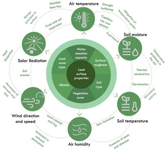
Microclimates are the result of the interplay of climatic factors such as soil and air temperature, solar radiation, air humidity, soil moisture, wind, and rain at local levels (Figure 1). Microclimate management at the local level can complement climate change mitigation and adaptation efforts and increase agricultural resilience against climate change. With good management practices, conducive and buffered microclimates can be created that enhance crop production. But how to integrate this microclimate perspective into natural resource management? This blog discusses 3 pillars.
Pillar 1 – Think small
Natural resource management often has a strong focus on big structures and large interventions. These actions are, of course, of high importance and will have significant impact once implemented well. However, the higher costs associated with these interventions result in high dependence on subsidies and existing government schemes. Microclimate management with low cost structures and small interventions, on the other hand, is quicker to implement and is less costly. The one should not replace the other but rather complement. For example, while a village is waiting for the government subsidy to build a large check dam, individual farmers could already grow hedgerows or grass strips on their plots to reduce wind erosion and maintain soil moisture.
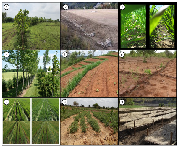
Smaller scale interventions can also be done more microclimate specific and should be implemented according to the needs of a specific local situation. A farm with high wind speeds can place a wind break perpendicular to the prevailing wind direction for example. Figure 2 shows more examples of small scale microclimate management practices.
Pillar 2 – Consider commons
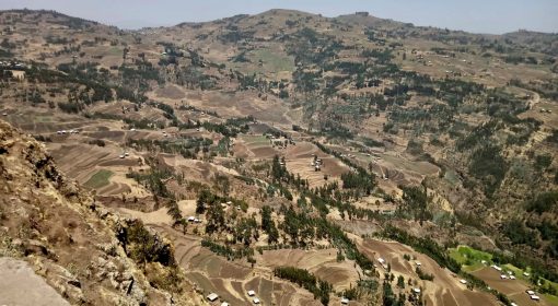
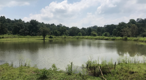
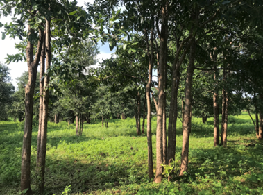
Whilst microclimate management at the small farm scale level is a great way to create conducive local conditions, larger landscape components such as large common ponds and forests are great factors in local climate buffering. A nearby forest can attract local rainfall through the biotic pump effect and buffers local temperatures. A common large pond replenishes the soil moisture levels of the village and also buffers in temperatures. During natural resource management, the important role of these ‘commons’ should be considered to enhance their positive effect on local climates. Photo 1 shows an example of a regenerated forest through Farmer Managed Natural Regeneration (FMNR). After deforestation practices, this hillside was completely bare and villagers around the forest noticed higher temperatures and dryer soils. This is why they decided to bring the forest back to buffer the temperatures and bring back the rainfall.
Pillar 3 – Mapping and monitoring
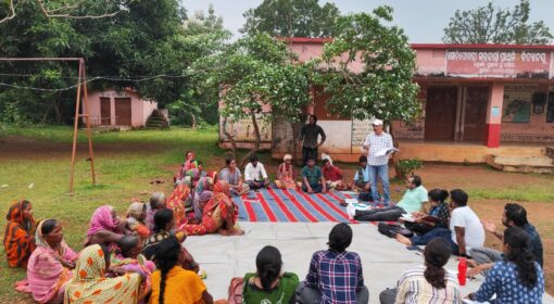
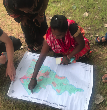
Natural Resource Management with a microclimate perspective requires good understanding of the microclimate and identification of certain hotspots that require improvement (For example, a part of a farm that is very dry or where it is warmer because of less shading). Identifying these hotspots can be done with a resource map focus group discussion (Photo 2).
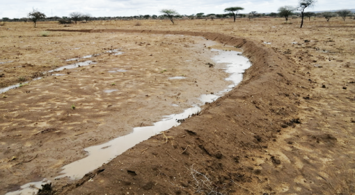
Once these hotspots are identified, certain interventions can be linked to these places. Some examples are to create shade in areas where crops and soil dry out from the sun, place bunds in an area with high runoff and low soil moisture, place windbreaks in areas where the wind blows hard and dries out the soil. After these interventions are implemented, monitoring allows us to keep track of how interventions are doing and if their effects are significant. This also allows for better and more consequent maintenance of structures. Pre-monitoring can also be done to assist in intervention planning. Table 1 gives an overview of monitoring tools.
Table 1 Overview of monitoring tools
| Monitoring tools to keep track of microclimatic changes | |
| Field sensors | Close monitoring on specific spots in farms (For example: tensiometers that measure soil moisture, thermometers that measure soil temperature, hygrometers that measure air temperature and humidity) |
| Remote sensing | Use of satellite to monitor on a larger scale |
| Face validation | Talking to land users to collect their views on how the landscape around them changed after specific interventions were done |
| Temporal map evaluation | Annually updating village maps to visualise the differences in land uses, conditions per year |

References
[1] https://udfcd.org/wp-content/uploads/2014/07/EC-12-Check-Dam.pdf
[2] Why consider sowing east-west? – WeedSmart