by Abdul Ghani Soomro and Anila Hameem Memon
February 12, 2020
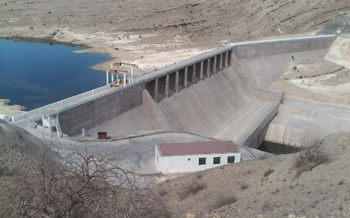
Darawat Dam is a concrete gravity dam developed across the Nai (spate) Baran River near the village of Jhangri in Jamshoro district of Sindh, Pakistan. It took three years for construction from March 2010 to March 2013. The dam is 250 metres (820 ft) in length and 43 metres (141 ft) in height, with a design storage capacity of about 150 million cubic metres (120,000 acre ft) of water, which can potentially help irrigate 10,000 hectares (25,000 acres) of land.
Before the construction of the Darawat dam across the Baran spate (Fig.1-4), the groundwater aquifers and their recharge rate were sufficient for agriculture and domestic activities. Agriculture was done mostly through spate irrigation systems.
The dam is a concrete one. The base concrete structure of the spillway has been constructed at a depth of 100 ft below the surface, and has stopped the underground movement of water towards downstream aquifers. The underground gallery has been developed within the structure (spillway) to monitor the movement of water (Fig. 5)
Subsequently, the groundwater aquifers have started to dry in the downstream of Nai Baran (Spate). The impact on the shallow aquifer zone has been evident over the past two years, as shown in the Fig 6. This has had adverse effects on the agricultural production and socio-economic conditions of the stakeholders, especially in the areas that continue to rely on the spate flow and that do not benefit from the newly managed irrigation flows, especially since the canals to bring water from the new reservoir have not yet been completed.
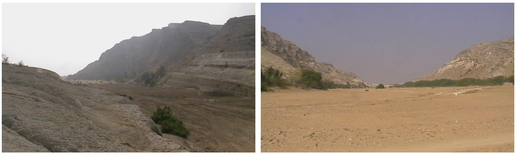
(Left) Location of Darawat Dam before construction of the dam and (Right) during the drought period before construction of the dam
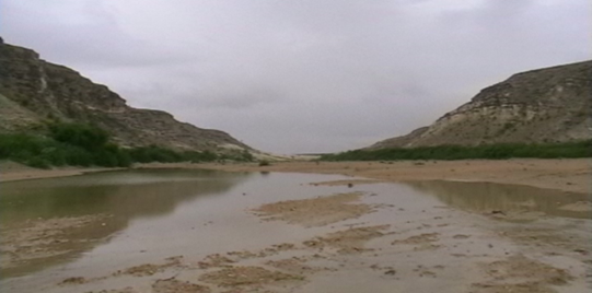
Upstream of spate Baran at Darawat Dam location, during the wet period before construction of the dam
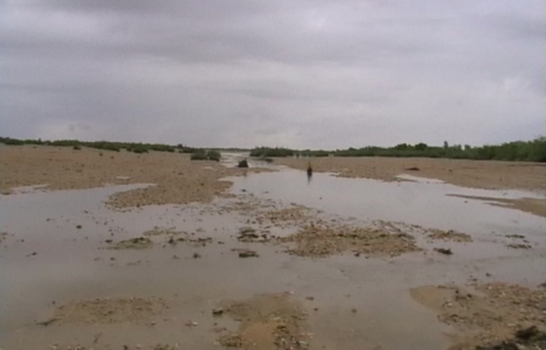
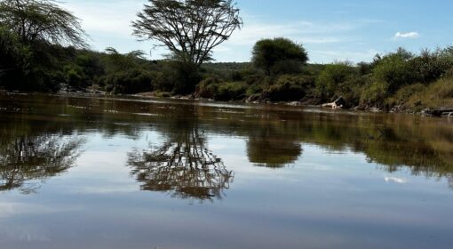
Downstream Darawat Dam during the wet period before construction of the dam
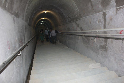
Basement Gallery of the Darawat Dam for monitoring of the underground movement of water
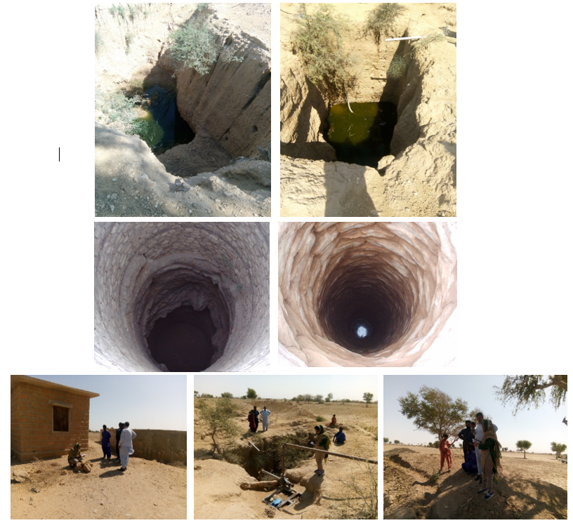
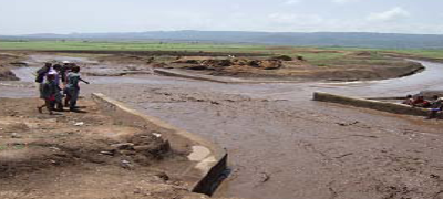
Dried/shrinkage of shallow wells and dried agricultural fields in the downstream of Darawat Dam
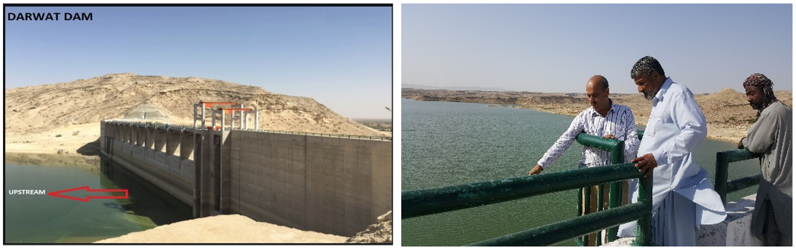
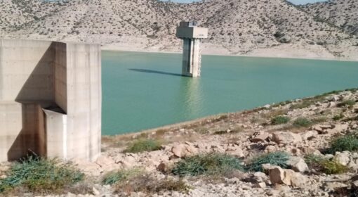
Upstream view of the dam reservoir
The Darwat dam’s design assumes a peak flood level of 119.86 metres and the likelihood of a peak flood once every 1000 years. The corresponding peak flood estimates every 50 and 100 years are 117.30 m and 117.78 m, respectively (Figure 7).
The dam is designed as a permanent structure across the natural streams and cuts off the subsurface flow up to a subsurface depth of 100 ft. The natural streams are the primary source of water needed to maintain the ecosystem in the region. Their water is also key to livelihoods in the upstream and downstream areas.
The groundwater aquifers are also recharged through rainfall, through some scattered natural depressions. The physiography of the region is unique. However, in these types of regions, small ponds are designed for use by communities for agriculture during periods when floods are at their lowest level. More of these ponds can be developed to boost the ecosystem, support agriculture, recharge aquifers, and boost socio-economic activities in general.
The downstream area is in poor health due to shrinking aquifers and degrading groundwater quality, which in turn is due to a lack of runoff and erratic rains. Since the dam construction, downstream communities simply haven’t had the option to tap into the runoff water; they are left completely at the mercy of the rains. People have started digging wells as deep as they can to ensure they have access to water. Solar pumps are being used to utilize such deep groundwater.
The dam itself has not started functioning as per plan, as evidenced by the delay in its filling up. This can be attributed to less-than-expected rainfall volumes, but also points to an overestimation by hydrological studies that preceded the construction.
As explained earlier, the downstream area has already been cut off from the runoff and has had to face many negative effects as a result. To correct these effects, an integrated approach needs to be taken to strengthen and enhance the periphery bunds to capture the downpouring rainfall and runoff from their adjoining parts of the barren lands.
The author has worked as an engineer for both private firms as well as government (Pakistan Agricultural Research Council). Most of the work has been in spate irrigation systems and the use of groundwater. In 2020 the author was awarded with a PhD at USPCAS-W/MUET-Jamshoro based on his research into ‘Hydrologic assessment of Khirthar National Range using remote sensing and modelling approach’. An overview of his published papers can be accessed through Research Gate.