Lessons from Amhara, Ethiopia
By Abebaw Zeleke, ORDA Ethiopia and Nardos Masresha
This blog is part of a dossier on locally-led adaptation, featuring insights and lessons from the Reversing the Flow (RtF) program. RtF empowers communities in Bangladesh, Burkina Faso, Ethiopia, Kenya, and Sudan to build climate resilience through direct funding and a community-driven, landscape approach.
In the Amhara Region of Ethiopia, where the local NGO ORDA, together with the communities implement the Reversing the Flow (RtF) approach, landscapes are understood not simply as physical spaces, but as living systems shaped by the interaction of people, water, vegetation, livelihoods, and climate. Measuring change in such landscapes, therefore, requires looking beyond individual interventions to understand how environmental restoration and community wellbeing evolve together.
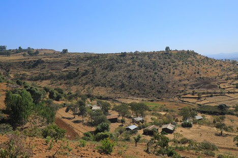
In the highlands of Koti Kebele in Yilmana Densa Woreda of North Gojjam Zone, where ORDA is supporting communities across six watersheds: Chinchiho, Kurfi, Dewol Washaye, Dawit Degami, Adafit, and Yibaba Gomengie. Together, these watersheds cover approximately 2,735 hectares and are home to 1,285 households, including 65 female-headed households, that often have limited access to land, credit, agricultural inputs, and decision-making opportunities, while carrying greater caregiving responsibilities.
Despite its considerable natural potential, the area has long faced challenges such as land degradation, soil erosion, deforestation, declining water resources, youth unemployment, and limited economic opportunities for women. To address these challenges, the RtF project supports communities in restoring degraded landscapes, improving livelihoods, and building resilience through integrated watershed management.
Understanding the Landscape as a Connected System
The Koti landscape is a mosaic of farmlands, grazing areas, forests, shrublands, water bodies, and settlements that interact across upper, middle, and downstream areas. Because these elements are interconnected, changes in one part of the landscape often affect conditions elsewhere.
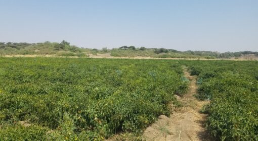
For example, soil erosion and degradation in upper catchments can reduce water availability and increase sedimentation downstream. Conversely, vegetation restoration and soil conservation measures can improve water infiltration, soil moisture, biodiversity, and agricultural productivity across the wider landscape.
Recognizing these connections, ORDA views landscape result measurement as both an environmental and social process. Understanding change requires not only measuring ecological improvements but also capturing how communities experience and benefit from those changes.
Communities as Landscape Monitors
One of the most important lessons from ORDA’s experience is that communities themselves are often the most consistent observers of landscape change. Through daily interaction with their environment, community members closely monitor changes in erosion, sedimentation, vegetation regeneration, water availability, soil moisture, and the survival rates of planted trees.
They also observe how restoration efforts affect livelihoods, household wellbeing, resilience, and local development opportunities.
Across ORDA’s intervention areas, community-based monitoring systems are already generating useful information. Communities document change through:
- Before-and-after photographs of restoration sites;
- Local records of rehabilitated and protected areas;
- Counting and measuring soil and water conservation structures, such as check dams;
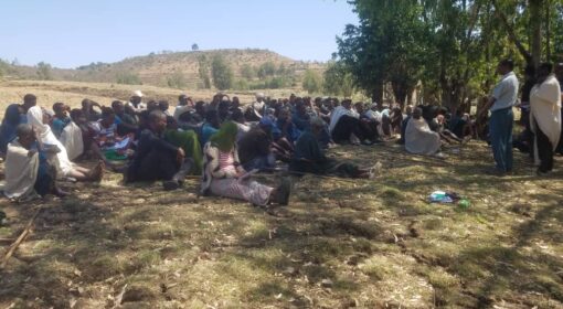
- Observation, reflection, and review meetings;
- Monitoring the number of trees planted and their survival rates;
- Tracking water infrastructure established through the project, including shallow boreholes; and
- Observing improvements in water access, reduced travel time for water collection, and associated health benefits.
These locally generated observations and documentation methodologies complement the hub’s formal monitoring system, which is based on project log frame indicators including: hectares of degraded land restored, tree survival rates, areas under seedling plantation, return of wild animal species, household access to credit, establishment and functionality of grassroots organizations and watershed committees, construction of shallow boreholes and water schemes, expansion of irrigable land, improvements in surface water flow duration, water system capacities (m³) and more others. Together, they help build a more complete picture of landscape transformation.
Visible Changes Across the Landscape
Within the Koti watersheds, changes are visible at both community and household levels.
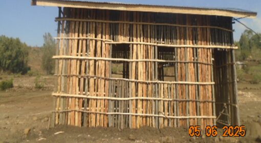
At the communal level, communities report significant improvements through the construction of soil and water conservation structures, establishment of area closures, regeneration of vegetation cover, and development of water supply schemes. These interventions help restore ecosystem functions and strengthen the productive capacity of the landscape.
At the household level, communities observe improvements in livelihoods and wellbeing. Increased water availability (communities have more water points), reduced time spent collecting water as both the distance to water sources and the waiting time to fill containers decreased due to increased water availability at water points, and improvements in hygiene and health conditions (reduced incidence of water-related diseases and associated medical expenses in households) are among the benefits frequently mentioned by community members. Some of these outcomes, while not originally captured through direct project indicators, are nevertheless recognized by communities as important signs of positive change.
Combining Community Knowledge with Digital Tools
The hub has also explored how digital approaches can strengthen landscape monitoring. Remote Sensing (RS), for example, can provide valuable information on vegetation cover, land restoration progress, ecosystem recovery, flooding patterns, and other landscape-scale changes over time.
ORDA sees the value in combining digital tools with participatory monitoring approaches. Community observations, visual documentation, local validation processes, and scientific analysis each contribute to different but complementary forms of evidence.
The experience from Koti demonstrates that communities are not passive beneficiaries of restoration efforts. They are active managers, observers, interpreters, and protectors of the landscapes in which they live. Their knowledge and participation are essential for understanding how landscapes are changing and whether restoration efforts are achieving meaningful and lasting results.
As ORDA and other RtF hubs continue strengthening landscape measurement systems, the focus is increasingly shifting toward integrated approaches that combine scientific data with community-generated evidence. Such approaches not only improve the quality and credibility of monitoring but also empower communities to use information for local decision-making, adaptive management, and advocacy.
Ultimately, the experience from the Koti landscape shows that landscape restoration is more than improving ecosystems. It is about strengthening the relationship between people and the natural resources on which their livelihoods, resilience, and future wellbeing depend.