By Nancy Kadenyi, Femke van Woesik, Theo Kioko, Jannatul Naim, Aida Zare, Rwnag Mohammed, Nardos Masresha, Avijit Choudhury, Kuntalika Kumbhakar
This blog is part of a dossier on locally-led adaptation, featuring insights and lessons from the Reversing the Flow (RtF) program. RtF empowers communities in Bangladesh, Burkina Faso, Ethiopia, Kenya, and Sudan to build climate resilience through direct funding and a community-driven, landscape approach.
The most solutions do not come from outside but from within communities themselves. When farmers, youth, women, people with disabilities, and local leaders all have a seat at the table, projects become shared commitments rather than imposed destinations. This blog highlights practical ways to move from consultation to co-creation showing how communities lead in shaping and sustaining solutions that matter to them:
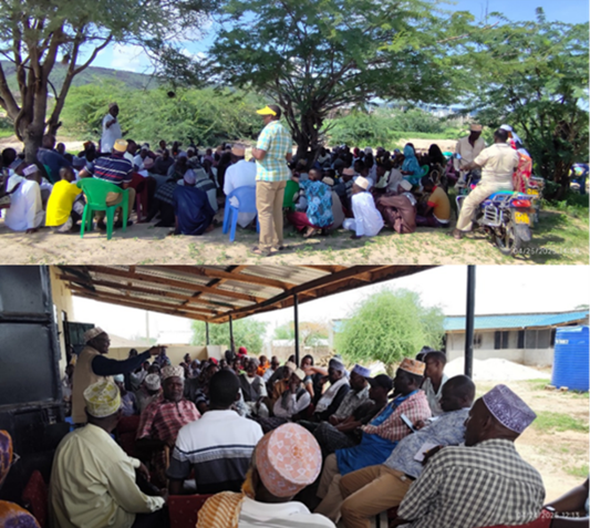
- Community Consultation forums
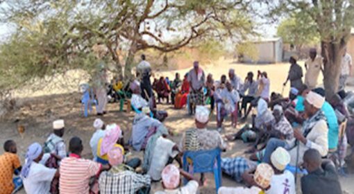
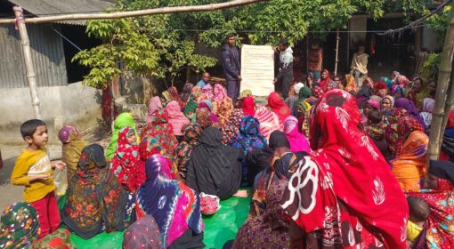
This is a space that provides the community with an opportunity to meet and share their thoughts, needs, and ideas for a project. It enables different partners and stakeholders to collaboratively co-design potentially viable solutions with the community, ensuring all the voices of the people in the community, e.g., women, youth, and PWDs, are heard and considered. These forums are essential for understanding and addressing the social dynamics and resource needs of the communities. It also helps in understanding the local context, leading to better tailoring of the interventions to the local situation for easy community adoption and ownership.
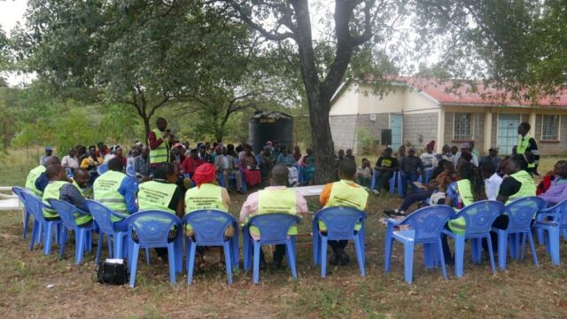
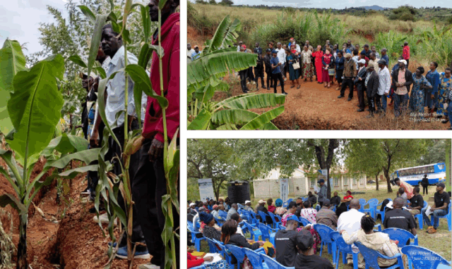
Example: In Isiolo County, Kenya, MID-P hosts open barazas under trees or market shades instead of distant, costly venues. Announcements are made in mosques and at market-day gatherings to reach everyone. This leads to higher attendance, more inclusive decision-making, and stronger ownership of selected initiatives.
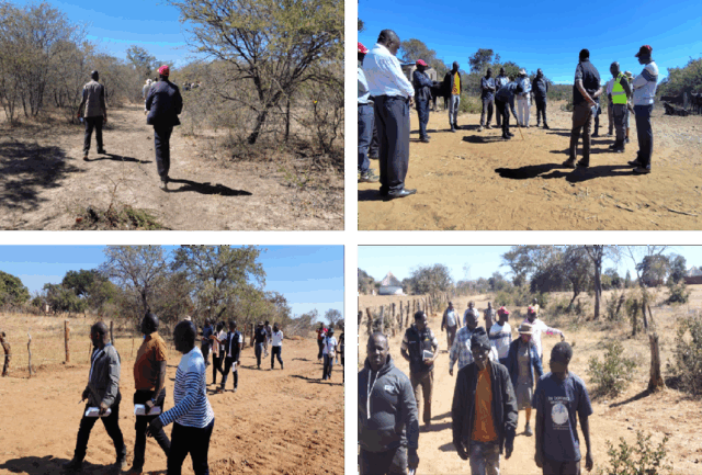
- Transect walk
A transect walk is like opening a living book of the landscape. Elders, community members, and technical staff walk together, pointing out erosion, gullies, or vegetation changes. Each stop becomes a shared learning moment linking expertise with lived experience.
Example: During the Green Roads for Water training in Zimbabwe (2025), participants walked across farms and streams to identify opportunities for water harvesting and restoration, sparking in-depth conversations about landscape change.
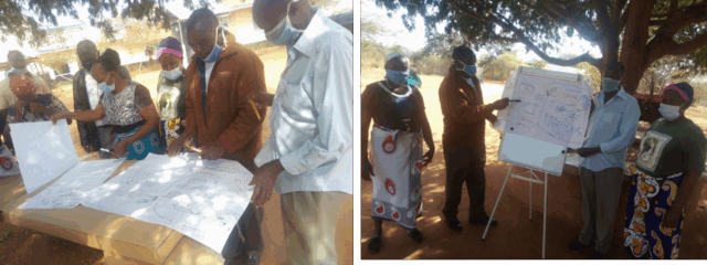
- Community social mapping and visualization
Visual tools help communities reflect on their environment and make informed choices. Seasonal calendars track rainfall, crop cycles, and pest outbreaks, while resource maps identify water sources, water harvesting areas, site-specific tree species, grazing areas, or flood-prone land. Such integrated approaches make project intervention planning easy and align community engagement activities with community availability as well as make the community gain a deeper understanding of their areas.
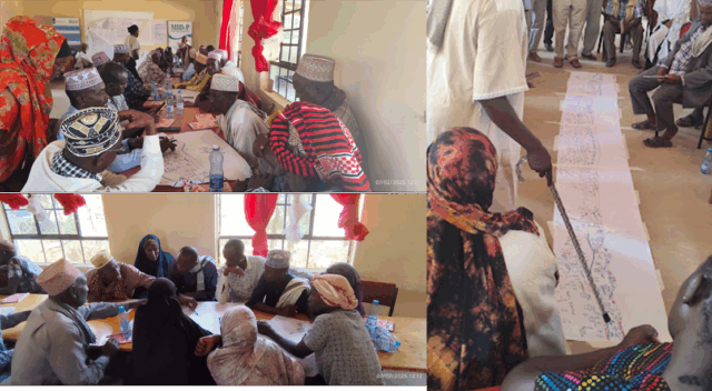
Example: During the ROFIP project, farmers in Kitui county created a seasonal calendar marking when rain typically arrives, which crops to plan and during which season and when pests are most aggressive. Resource mapping with this community also revealed interventions such as runoff harvesting and pasture production, which the farmers prioritized, and key areas were made a future visualization on how their farms would look with the adoption of runoff harvesting and pasture production.
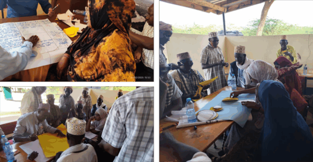
- Participatory GIS (P-GIS)
Participatory GIS combines the technical power of GIS and remote sensing with the knowledge and perspectives of local communities. Instead of top-down mapping, it enables communities to chart their own resources, challenges, and opportunities. This approach makes spatial planning more inclusive, equitable, and practical — while also strengthening social justice and community ownership.
Example: In the Drain to Gain project, P-GIS became a meeting point between digital tools and community knowledge. Using platforms like Kobo Collect and Google Earth Storytelling, communities worked with ToTs and local authorities to map gullies, eroded lands, and bare areas, as well as success stories such as pasture restoration and sustainable mango production. The maps did more than document problems, they turned community stories into action plans and site-specific interventions.
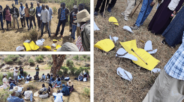
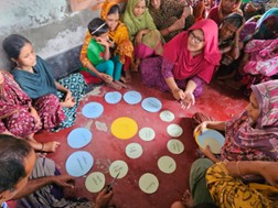
- Venn diagram (Chapati/pizza analysis)
The chapati or pizza analysis helps communities visualize the different stakeholders in their landscape, how they relate to each other, and what needs to change to achieve a more resilient society and healthier environment. Using circles to represent actors, communities map power dynamics, influence, and relationships in a simple, visual way.
Example: During RtF learning events in Laikipia and Isiolo (Kenya), communities used chapati analysis to place stakeholders around a central issue or project. Each circle represented an actor, with its size showing relative influence and its distance from the center reflecting accessibility. The exercise revealed not only external actors but also the community itself as a stakeholder — one that may contribute to challenges but also holds the power to shift the status quo. It also highlighted that communities sometimes assign too much weight to facilitating agencies, a bias that can be corrected with proper facilitation.
Chapati analysis does more than map relationships. It helps communities develop engagement strategies with each stakeholder, monitor progress, and recalibrate efforts. When repeated after a year, it becomes a self-assessment tool, showing how relationships and perceptions of influence have evolved through ongoing engagement. If the exercise is repeated with the same community after one year, it becomes a self-assessment and reflection tool to understand how the relationships have changed and how the mental model of the stakeholders has evolved over the last year through the strategic engagement that was planned.
- Planning with clear timelines
Community planning is not just about setting dates and targets. It means aligning activities with local seasons and events so that timelines are realistic, practical, and fully owned by the people.
Example: During the Drain to Gain project, farmers, ToTs, and elders gathered under a Terminalia brownii tree at the Ward Administrator’s office to prioritize initiatives. They quickly recognized that no plan would succeed if it overlapped with planting, harvesting, or cultural celebrations. By respecting these rhythms, the plan evolved from a list of milestones into a true community roadmap. The result: swift implementation and strong results, even though the co-creation phase itself took more time.
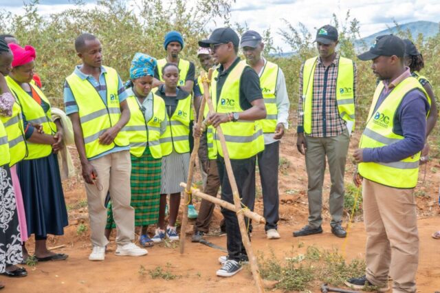
- Solution co-development, community joint learning, and site training
When the community actively takes part in project co-design and co-development, they easily take ownership by taking pride in the initiative. By co-developing and co-designing project interventions with the community, the community can feel a sense of ownership over the project, making it easier for adoption, implementation, and maintenance. It goes beyond discussions and consultations under a tree by incorporating both theoretical and practical joint learning. This enhances the relevance and feasibility of project interventions within the community capacity and context.
Example: In the Drain-to-Gain project, farmers received on-site training in road runoff harvesting, learning how to channel excess water to their fields. Trained farmers (ToTs) then passed on these skills within their villages, adapting techniques to local terrain and climate. Follow-up visits by ToTs and project staff over several months ensured farmers had support to troubleshoot challenges, reinforce maintenance, and build confidence.
Farmer-to-farmer exchanges further accelerated uptake. Farmers from Machakos and Kitui counties visited their peers in Makueni to see soil and water conservation practices such as terracing, gully rehabilitation, and pasture restoration. Hearing directly from fellow farmers (in their own language and grounded in practical experience) made the knowledge relatable, trusted, and easier to replicate.
This cycle of co-development, training, follow-up, and peer learning turns new ideas into widespread community-led practices that last.
Resilience and adaptation are not only technical achievements — they are inclusive and collective efforts, strengthened by wisdom, creativity, and local experiences. Participatory engagement shifts development from something done for communities to something done with them, ensuring that interventions are relevant, locally owned, and sustained.
A key takeaway from these approaches is that communities (farmers, youth, women, elders, and local leaders) can walk hand in hand with technical experts. In this process, knowledge becomes power, turning challenges into opportunities.
In Isiolo, the Mayanat group, supported by RtF and IMPACT, transformed 30 hectares of bare land into thriving pasture using semi-circular bunds. They now share their story with visitors, compare their results with neighboring landscapes, and explain what worked in their own words. Their experience shows what happens when communities are not just participants but knowledge generators: resilience grows, and landscapes can recover.
Call to Action
Development partners, governments, policymakers, and practitioners should champion spaces where every voice counts and invest in interventions that communities themselves lead.