by Sam Agbadonou & Lucia Moreno Spiegelberg
Pour la version en français, cliquez ici.
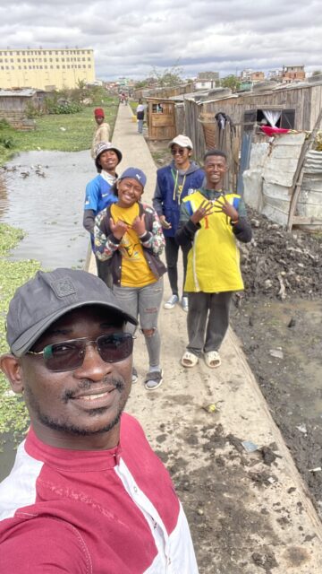 | 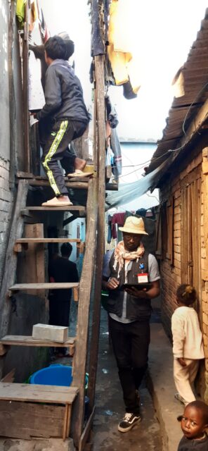 |
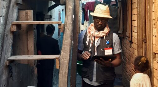
Sam Agbadonou during a mapping expedition in Antananarivo, Madagascar
Sam Agbadonou, a Beninese member of the OpenStreetMap (OSM) community since 2013, has played a key role in participatory mapping with OSM in Benin. OSM aims to create a free, open-source map of the world, contributed by volunteers and accessible to all. Sam’s work has been instrumental in mapping previously uncharted areas, particularly through collaborative initiatives like Map & Jerry.
“My work focuses on mapping areas that have previously been uncharted,” Sam explains. “Since 2016, I’ve collaborated with IRD on various missions. My main task is to put these unmapped regions on the map. One of the projects I worked on is called Map & Jerry, which uses participatory cartography to achieve this goal.”
The Map & Jerry project
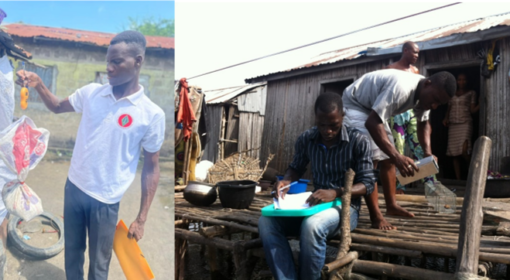
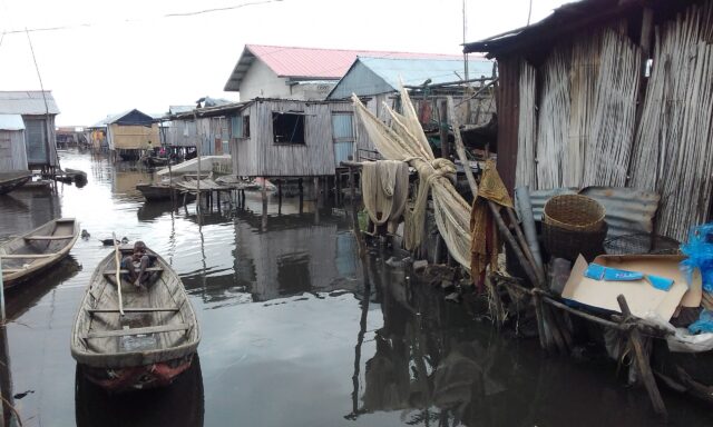
Map & Jerry project focuses on Ladji’s neighbourhood, an informal settlement that doesn’t appear in the official maps of Cotonou despite being inhabited for at least three centuries, and being strategically located near Dantokpa market (the biggest in West Africa) and Lake Nokoué. Only recently this is leading to an increasing interest from the local authorities. In 2016, the government planned to build a road through what is now Ladji, and the eviction threat added up to the general invisibility of Ladji’s neighbourhood. In this context, the Map & Jerry project was born with the aim of including Ladji in Cotonou’s map through a collaborative effort with the residents, putting Ladji on the map literally and metaphorically.
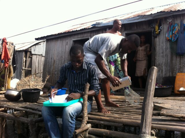
A “Jerry” is a low-cost, low-tech computer built from recycled materials, housed in a jerrycan. It uses open-source software and is designed to run lightweight systems, making it affordable and accessible to local communities. As part of Map & Jerry, residents were trained for three days to use free OpenStreetMap tools. They collected data offline with smartphones using the ‘OSMand’ app and took geolocalized photos with ‘Mapillary.’ The participants then applied their skills to map their own neighbourhood. In this way, the residents of Ladji themselves provided the first cartography of this area ever. Furthermore, after having a base map, they gained the opportunity to think along about development and planning projects in Ladji, presenting this to local authorities.
SCARIA project
“Everything open-source is my lead motive. If it’s open, it’s good for me “, Sam explains. Open-source maps are essential for projects like SCARIA, in which researchers collaborate with marginal neighbourhood residents to sustainably mitigate rodent issues, like rodent-borne diseases or rodent-related damage and losses. Sam worked closely with the communities to map strategic areas of the African cities included in the project, namely Niamey in Niger, Cotonou in Benin, Wolaita Sodo in Ethiopia, and Antananarivo in Madagascar. “Our goal is to show the community and scientists alike how to use open-source software. It is available for all if they only know how to use it.”
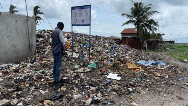
Participatory mapping not only provides accurate, locally relevant maps of study sites for spatialized analysis, but it also fosters trust and collaboration between academics, the OSM community and residents. In SCARIA, Sam’s work is tailored to track the associated urban and social characteristics (e.g., markets, dumpsites, population density, landscape features, etc.) that may favour rodent presence and movements, which in turn is crucial for understanding the spread of zoonotic diseases (such as plague, leptospirosis or typhus) in these poorly documented areas.
“In Madagascar, we tracked rat movements by placing food with colour markers. This allowed us to map how far the rats travel throughout the neighbourhood habitat. Doing so, we can determine the extent of their movement, and how landscape can influence them”. Something researchers are very interested in, specifically in knowing how far rodents may move within the city. This is very important for rodent management because it gives us concrete elements about the spatial scale at which rodent control should be implemented. Especially in a highly populated urban context, this comes very specific and will teach us a lot about the approach in terms of community involvement.
The challenges of mapping tiny mammals
Normally, cartography deals with things outside, such as buildings and streets. However, tracking rats with traps happens indoors, and it can be quite challenging to obtain an accurate position. He explains. “I mark their position inside the buildings, but it’s not always accurate. Ideally, I’d map each house individually, but that’s not always possible because of the complexity of the slum habitat.”
The challenges in mapping for SCARIA and associated programs also include the wide variety of contexts and communities. Sam has adapted his mapping skills to various terrains, from the mountains of Ethiopia to the wetlands of Madagascar and Benin. He appreciates the opportunity to teach and learn across different regions, “If they ask me again, I will join.”
The team in Ethiopia, consisting of staffs from the University of Wolaita Sodo, was trained in a combination of digital data collection methods. Initially, the team planned to use pen and paper for fieldwork, but Sam introduced various applications to streamline the process and increase efficiency. Phones were used for data collection through the KoboToolbox, alongside marking rat traps with GPS points. One significant challenge was the lack of existing data in the area, and another was helping people understand altitude differences and clarifying this on the map. Sam plans to address these issues in the next phase to optimize the potential of participatory mapping, utilizing the local knowledge of residents and helping both residents and academics present their data and findings clearly. This clarity and visual representation is crucial for convincing policymakers in development work.
Community engagement in participatory mapping
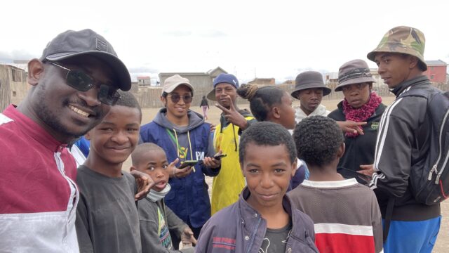
The participation of the community is necessary for the data collection of many projects and research, especially for mapping an informal area which lacks “official” data. However, when the approach is not collaborative, the product is likely prioritized over the process, and the community might often feel not recognized or exploited. Participatory methodologies, like participatory mapping, can be a win-win situation, literally putting areas and topics on the map and providing a necessary foundation of spatial data crucial for strategizing implementation. For example, in the case of the Map & Jerry project, the existence of a map for Ladji was discussed by the head of the district as a tool to legitimize their demands for basic sanitation and services to Cotonou’s government.
Participatory mapping has immense potential, especially when combined with other data sources like satellite imagery, which can complement ground-truthed, localized data, or real-time monitoring systems. It may also facilitate acquisition of data from domestic or peri-domestic spaces that are very useful but sometimes not accessible to people outside the community. Open-source participatory mapping can be used to monitor impact, making it a powerful tool for both community engagement and effective policy-making. It can also contribute to building community skills and involvement, linking spatial setups to intricate urban areas, and raising awareness among agencies responsible for development.
However, participatory mapping also has its limitations. Even though the OSM methodology is open to everyone, there exist gaps in terms of skills and digital access between the population of low income neighbourhoods and the qualified members of the OSM mappers community. Furthermore, even if the community’s digital skills are improved during a project, the lack of basic resources would make it impossible for many members of the community to access digital technologies. For instance, in Ladji, the prices of internet and electricity are so prohibitive that even though the community has access to the Jerry’s used during the project, most cannot actually afford to use them and to mobilize and valorise their newly acquired skills.
Participatory mapping can be a powerful tool, helping researchers and communities address many topics. In the SCARIA project, the wide opportunities for innovation that tools like KOBO or OSM have been shown. However, if we want to democratize technology and digital skills, we should look at the infrastructure problems and lack of resources that feed the digital gap in the first place.
Resources
Choplin, A., & Lozivit, M. (2019). Mettre un quartier sur la carte: Cartographie participative et innovation numérique à Cotonou (Bénin). Cybergeo: European Journal of Geography.
Virgens, M. N. D., Brito, P. L., Lustosa, R., Pedrassoli, J., Ulbrich, P., Albuquerque, J. P. D., … & Costa, F. (2024). Cartographic Resources for Equitable University–Community Interaction in Slum Areas. Urban Science, 8(1), 20.
This blog is part of a series of blogs on SCARIA where we work towards sustainable community-based mitigation of rodent issues in the African cities of: Niamey in Niger, Cotonou in Benin, Wolaita Sodo in Ethiopia and Antananarivo in Madagascar. In Benin, we work in the neighbourhood of Ladji, a ‘refugee village built on stilts’ which is part of the city of Cotonou, where fishing and informal business are the main sources of livelihood.
