by Leon Casse
November 16, 2020
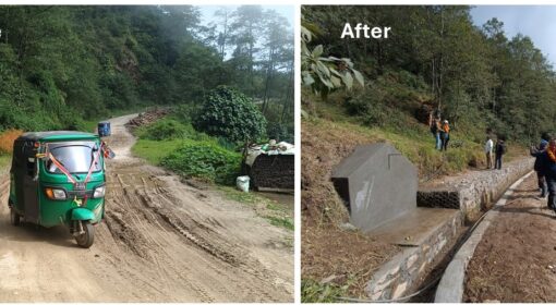
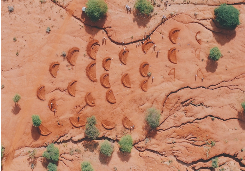
Over the past years Justdiggit has carried outs multiple interventions in southern Kenya in order to re-green the area and to reduce erosion. This is mainly done by reducing the overland flow of water through improving the infiltration by, among other methods, digging rainwater harvesting bunds (see picture below). These bunds store water and let it infiltrate, preventing it from flowing away. This has resulted in less erosion, an increase in vegetation cover, and a reduction in local temperatures. However, there may be another process that can be influenced; namely the local carbon cycle and with that the potential for (soil) carbon sequestration. Carbon sequestration is defined as atmospheric carbon that is taken up and stored by vegetation or the soil, and is therefore no longer re-emitted back into the atmosphere.
Semi-arid grasslands systems such as in southern Kenya usually store relatively little carbon and most of this carbon is stored in the soil (around 90%). The high temperatures and long dry season result in relatively low carbon inputs into the soil since vegetation productivity is low, while soil organic carbon decomposition is usually relatively high under these circumstances. The high decomposition results in a relatively large fraction of the carbon inputs being released back into the atmosphere. However, since semi-arid grasslands are one of the most extensive ecosystems on the planet, they do have the potential to store large amounts of carbon below the earth surface. As current soil conditions are generally in equilibrium (i.e. carbon inputs from vegetation are equal to carbon output through decomposition) a change in land management practices like those carried out by Justdiggit can enhance vegetation productivity, thereby increasing carbon inputs into the soil and potentially resulting in increased carbon storage.
Methods for studying changes in soil carbon stock
To study carbon sequestration over a large area, one needs to capture the variation within the study area well. When solely using measurements of soil organic carbon, the density is usually too low and therefore the variation is not observed accurately. The use of measurements also tends to be a time consuming and expensive practice which only provides results over a relatively long period of time. Over the last few decades, modelling and remote sensing approaches have been introduced as methods that can be used to get an overview of the variation in soil organic carbon in an area. These methods still require measurements for training data, model input ,and/or to test the accuracy of the models and remote sensing approach.
Here we will dive a bit deeper into the remote sensing approach as this is a relatively new and interesting method with much potential. This approach is based on a theory that changes in soil organic carbon can be observed by a sensor (often a satellite) due to changes in soil reflection at certain wavelengths. That this is possible can already be seen when we look at a carbon rich soil, as these tend to be darker (reflecting less radiation) than soils that are low in organic carbon. But besides this change within the visible part of the spectrum, changes also occur in the shortwave infrared wavelengths (1 to 2.5 μm) due to the absorption of radiation by multiple organic compounds (e.g. lignin, cellulose, chlorophyll, etc.). Since there is a lot of information in a satellite image (e.g. Sentinel-2 satellite has 12 bands with a resolution between 10 and 60 meters) it is not possible for humans to analyse all this data. Instead, machine learning methods are used to analyse it and find a statistical relationship between the reflection data and soil organic carbon measurement (training data). These machine learning algorithms, such as Random forest or Support Vector Machines, are then able to classify other locations where no measurements are available, using this statistical relationship. This way, it is possible to provide many individual observations (pixels) of soil organic carbon which provides an overview of the variation in soil organic carbon over a large area.
The past, present and future of soil organic carbon analysis
Since satellite images can now be used to study the soil organic carbon content we are not limited to measurements only in the present and the future. Satellite images are already available since the 70’s providing data over a long period of time. It has to be noted that the first satellites may not have been as accurate as present-day sensors, so these may not all be relevant for soil organic carbon studies. However, for at least last two decades, satellites have been providing good enough quality data to study the soil surface. This provides the possibility to even study the carbon sequestration in the past, assuming the measurements are available to train the machine learning algorithms.
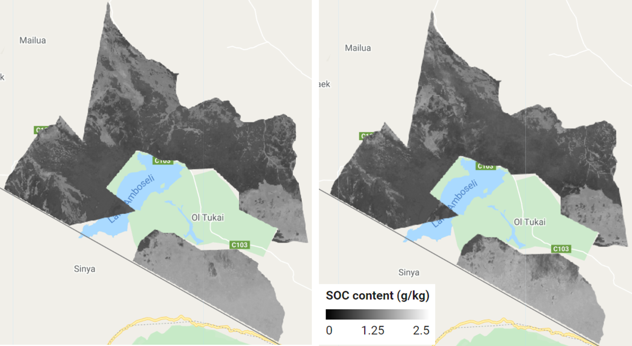
When we now look at the area in southern Kenya where Justdiggit has carried out its interventions (OOGR area), it can be seen that at this point in time no significant change in soil carbon stock has occurred since the start of the intervention practices (2016). Soil organic carbon images such as those below were used to analyse the soil organic carbon over time. These images were produced using the remote sensing approach in combination with measurements taken during a field campaign in 2019. During this field campaign measurements were performed on soil organic carbon as well as sand, clay and silt content. The change in this soil organic carbon is expected to indicate the amount of carbon stored (or lost) in the topsoil over a specific time. However, soil organic carbon observations from Landsat 8 and Sentinel-2 satellites over a period from 2016 to 2019 currently shows no differences at the intervention sites. The difference in soil organic carbon between the intervention sites and a control area without interventions did not yet show any difference either.
It is important to keep in mind that carbon sequestration in soils is a slow process. This means that when you want to observe the changes in carbon stock over time in a specific area this needs to be studied over a long period of time (many years or decades). The areas studied in southern Kenya are subject to intervention practices for only a few years so relatively little changes in carbon stock is expected and this was confirmed by the satellite observations. To study the future changes in the soil carbon stock the soil organic carbon content needs to be analysed in the future. This can be done with the remote sensing approach since satellite images remain freely available and easily accessible in the future. This makes this remote sensing approach very accessible and a good alternative to models or extensive measurement campaigns on the ground.
The use of satellite images to study the soil organic carbon content proves to be relatively accurate. However, it tends to underestimate high soil organic carbon content. Despite this, it does still have good potential for future soil organic carbon analysis as long as representative measurements are available to train the algorithm. The accuracy of this method can only be tested for the years with available measurements. Currently it is not yet known whether the classification of past and future satellite images with no measurements to train and validate these classifications is accurate, so this will require more research. Thus, it is recommended to perform more soil measurements in southern Kenya in the future in order to validate whether observed soil organic carbon for past and future satellite images are accurate. Further, it is also recommended to study the soil nitrogen content as this can have a considerable impact on the soils capacity to store carbon. When nitrogen content in the soil is low it is likely that little carbon will be stored as more organic carbon has to be decomposed by soil organisms in order to get enough nitrogen.
So, as the intervention practices and their outcomes on the local ecosystem continue, it is interesting to see what its effect will be on the soil. The slow accumulation of organic carbon will make it difficult to observe potential changes at this point in time. However, if the total vegetation cover increases it is likely that additional carbon will build up in the soil. This means that it will be interesting to keep studying the carbon sequestration over longer periods of time, not just because it can result in improved soil conditions (e.g. better soil fertility and water infiltration) but also because it could be a considerable sink for atmospheric CO2, possibly helping to mitigate climate change.