By Mst Jannatul Naim, Humayra (Hajrakhali community volunteer), Zahid Amin, Md. Shirazul Islam, Md. Mehdi Hasan Suvo, Mahmuda Yasmin Kona (Uttaran)
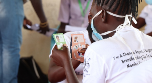
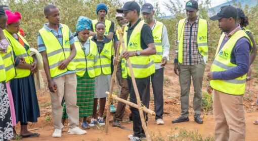
This blog is part of a dossier on locally-led adaptation, featuring insights and lessons from the Reversing the Flow (RtF) program. RtF empowers communities in Bangladesh, Burkina Faso, Ethiopia, Kenya, and Sudan to build climate resilience through direct funding and a community-driven, landscape approach.
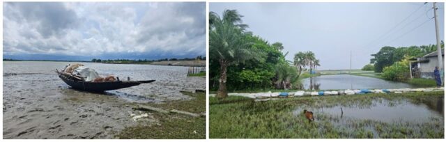
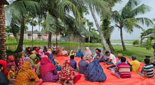
It was a quiet afternoon in Hajrakhali, a small riverside community nestled along the Kholpetua River in Asasuni, Satkhira in Bangladesh. The monsoon season was nearing its end, leaving behind vast stretches of waterlogged fields and submerged roads. Just beside the community, a large canal overflowing and a damaged embankment: a reminder of the recurring waterlogging challenges the community faces every year.
Overlooking the heavy rain outside, the meeting convened on the old elevated concrete balcony of Mr. Galib Sana’s house, where members of the Landscape Management Committee (LMC) – men, women, and youth – gathered in a circle. Spread across the floor were sheets of colored paper, carefully cut into round “chapatis.”
“Today,” smiled the community volunteer, holding up one of the circles, “we will play a game to see who really helps us solve our problem of waterlogging.”
Everyone nodded knowingly. This year, the stagnant water had stayed longer than ever, destroying vegetable gardens, damaging homes, and making roads impassable. The root cause, they agreed, was the damaged embankment of the Kholpetua River: during monsoon tides, salty water overflowed into the canals, blocking natural drainage. Almost every earthen road within the village had become unusable. Children could not reach school, and elderly people were trapped in their homes.
Amid this hardship, the volunteer (Humayra Parvin) introduced a participatory game she had learned about at a community knowledge exchange under the RtF project: the Chapati Game. She believed it could help the villagers plan, discuss, and advocate together for lasting solutions to their waterlogging crisis.
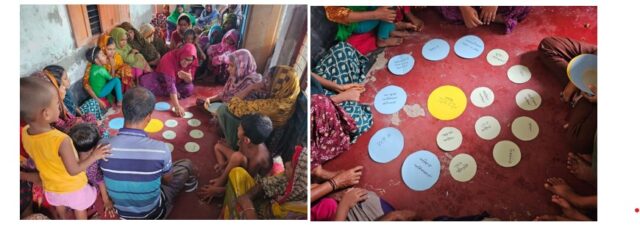
The ‘Chapati’ Game
The Chapati Game is a community dialogue tool that helps people visualize their relationships with different stakeholders such as government offices, NGOs, and other actors involved in addressing local problems. It enables communities to identify and prioritize key issues, explore possible solutions, map the institutions and individuals who can support them, and assess how much access and support they have from each one. Through this process, the game also reveals gaps and opportunities for policy advocacy. In the game, each circle or “chapati” represents a stakeholder, where the size of the chapati indicates the level of support or resources they offer, and the distance from the community shows how easy or difficult it is to access them.
How It Worked in Hajrakhali
The Landscape Management Committee (LMC) began by identifying their one of main challenge: waterlogging. “Every year we suffer,” one woman shared. “Damaged embankments, cyclones, and heavy rains flood our homes. We repair roads, but without drainage, the water stays for months.”
The group then started mapping their relationships through the Chapati Game. In the center of a large paper circle, they wrote: “Hajrakhali Community – Waterlogging.”
Around it, they placed colorful “chapatis” to represent key stakeholders:
- Union Parishad (local government office) a small circle placed close to the center, as the office is nearby but community access remains limited.
- Department of Public Health Engineering (DPHE) and Local NGOs with medium-sized chapati, somewhat distant, reflecting occasional involvement in drinking water solution.
- Bangladesh Water Development Board (BWDB) with a large chapati placed near, showing that the local office provides some maintenance support for embankments and temporary measures to stop riverbank breaches, with frequent community visits.
- Landscape Management Committee (LMC) with a large, close circle, symbolizing strong local leadership under RtF program.
- Uttaran NGO: a large, mid-distance chapati, representing a supportive partner, though not permanently based within the village.
- RVO (The Donor of the RtF program): a large chapati placed far away, representing strong support through regranting directly to the community, though their presence remains physically distant.
As the circles took shape, discussion deepened: “Why is the Union Parishad close but small?” someone asked. An elder replied, “Because they are near us, but we cannot always reach them when we need help.”. Through laughter and reflection, the community began to see their relationships and responsibilities more clearly.
By the end, the diagram told a clear story: power and proximity don’t always align. Some institutions close to the community were less responsive, while distant ones, like donors or national programs, provided major assistance. It helped the group reflect:
Who helps, who doesn’t, and why?
- What can be done to make small chapatis larger: meaning stronger support and accountability?
- Which institutions should be brought closer to ensure sustainability?
Through the Chapati Game, the Hajrakhali community realized they already understood their institutional landscape: who matters, how, and where the gaps are. The tool simply helped visualize that collective knowledge, transforming invisible experiences into a map for action and next steps:
- Visit the Union Parishad, BWDB and other relevant stakeholders more frequently and invite local officials to field discussions and visits.
- Document waterlogging issues and solutions in their meeting resolutions and implement for next year community landscape plan and budgeting.
- Use the chapati map in meetings with higher authorities to advocate for speeding up the permanent solution of the damaged embankment.
The session concluded with the Hajrakhali community standing proudly beside their colorful chapati map: a vibrant symbol of unity, awareness, and collective voice. Through this exercise, help them to realize that meaningful change doesn’t always begin with money; it begins with dialogue, reflection, and a shared sense of ownership. The Chapati Game had not only mapped relationships, it also inspired confidence that solutions can emerge from within the community itself.
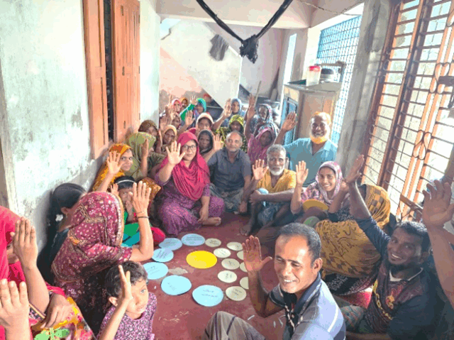
Hajrakhali community members participating in the Chapati Game — mapping and shaping colorful “chapatis.” (Photo by: Mst Jannatul Naim)