By Hasna Heena Mahmud, Aysha Akter Smrity, (Uttaran) and Redeat Daniel Ayele, Mst Jannatul Naim (GopaMetaMeta)
This blog is part of a dossier on locally-led adaptation, featuring insights and lessons from the Reversing the Flow (RtF) program. RtF empowers communities in Bangladesh, Burkina Faso, Ethiopia, Kenya, and Sudan to build climate resilience through direct funding and a community-driven, landscape approach.
Across the southeast part of Bangladesh, in Satkhira area, communities live within a complex network of tidal rivers, canals, wetlands, agricultural lands, shrimp farms, and embankments. Water connects everything. When canals become blocked upstream, downstream villages remain waterlogged for months. When embankments collapse, saline water enters crop fields and freshwater ponds. Climate risks move through the landscape, crossing administrative boundaries and affecting interconnected ecosystems and communities alike.
Recognizing this reality, the Reversing the Flow (RtF) LANDWATER initiative approaches adaptation differently. Rather than treating villages as isolated units, the programme works across eight interconnected landscapes of living socio-ecological systems where ecosystem health and community wellbeing are deeply interdependent.
Landscapes Defined by Water, Not Boundaries
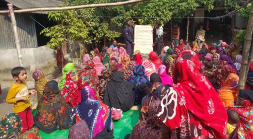
The eight landscapes of Uttaran Hub are shaped not by administrative borders, but by shared ecosystems including rivers, canals, wetlands, agricultural lands, and embankments. Communities themselves identified the key challenges affecting their landscapes through participatory mapping, baseline assessments, and collective planning exercises. The challenges were remarkably similar: prolonged waterlogging, saline drinking water, damaged roads, weak embankments, loss of freshwater sources, and reduced mobility during monsoon seasons.
For generations, communities have depended on the surrounding landscape for their survival and prosperity.In Hajrakhali, Puijala, and Chakla, families living beside embankments rely largely on fishing and daily labour linked to rivers and canals. In Bagebeel and Zeyala, agriculture, livestock, and small businesses depend on fertile land and functioning water systems. In Godaibeel, life has long been shaped by persistent waterlogging and limited connectivity.
But communities do more than depend on ecosystems; they actively shape them. Every canal restored, embankment repaired, or freshwater pond protected influences the health of the wider landscape. Over time, communities have come to recognize that investing in ecosystem restoration is also an investment in their own future.This realization has encouraged a shift toward nature-based, locally led adaptation solutions that strengthen both environmental resilience and human wellbeing.
How communities measure landscape change
Communities in the Uttaran landscape measure change by observing what improves around them. For them, change is not only about landscape ecological health, physical structures, or livelihoods, it also includes better living conditions, improved health and hygiene, and enhanced economic well-being. These reflections provide a clear and grounded picture of landscape transformation.
Community members assess how the entire system functions. For example, a better elevated road means not only climate-resilient infrastructure to address waterlogging but also easier mobility, which opens up income opportunities, strengthens livelihoods, and improves access to health services. Climate-resilient infrastructure contributes to ecosystem recovery and reduces salinity. A restored canal improves drainage, while a stronger embankment protects land, ponds, and homes. Access to freshwater enhances health and builds confidence among families.
One of the most distinctive features of the RtF approach is community-led monitoring. Rather than relying solely on external indicators, communities measure progress through the changes they experience in everyday life. They ask practical questions:
- Has water drained faster after rainfall?
- How many days do they have to stay waterlogged?
- How many cyclones did they face last year?
- Is drinking water safer during saline periods?
- Are livelihoods becoming more stable?
- Can women, children and older people travel safely during the monsoon?
- Are women and marginalized groups participating more in decisions?
- Is accessibility to markets and other services improved?
- Is government advocacy working within the community?
In Godaibeel, community member Koli remembers a time when her community remained isolated for much of the year:
“For nearly twenty years, our road stayed underwater for eight months annually. Children struggled to attend school, and many suffered from waterborne diseases. Today, because we built this road together, we can reach schools, markets, and services much more easily.”
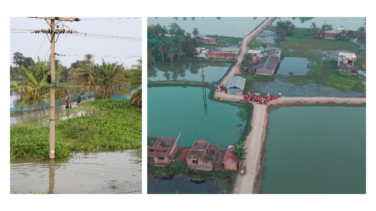
These stories reveal that resilience is not only about infrastructure, but it is also about improving everyday life.
Monitoring Through Participation and Learning
Communities monitor progress through regular site visits, meetings, participatory mapping, scoring exercises, photographs, and videos.
Shyamol from Puijala explains:
“These are our projects. It is our responsibility to be present during construction, to ensure the work is done properly and continues to serve us in the future.”
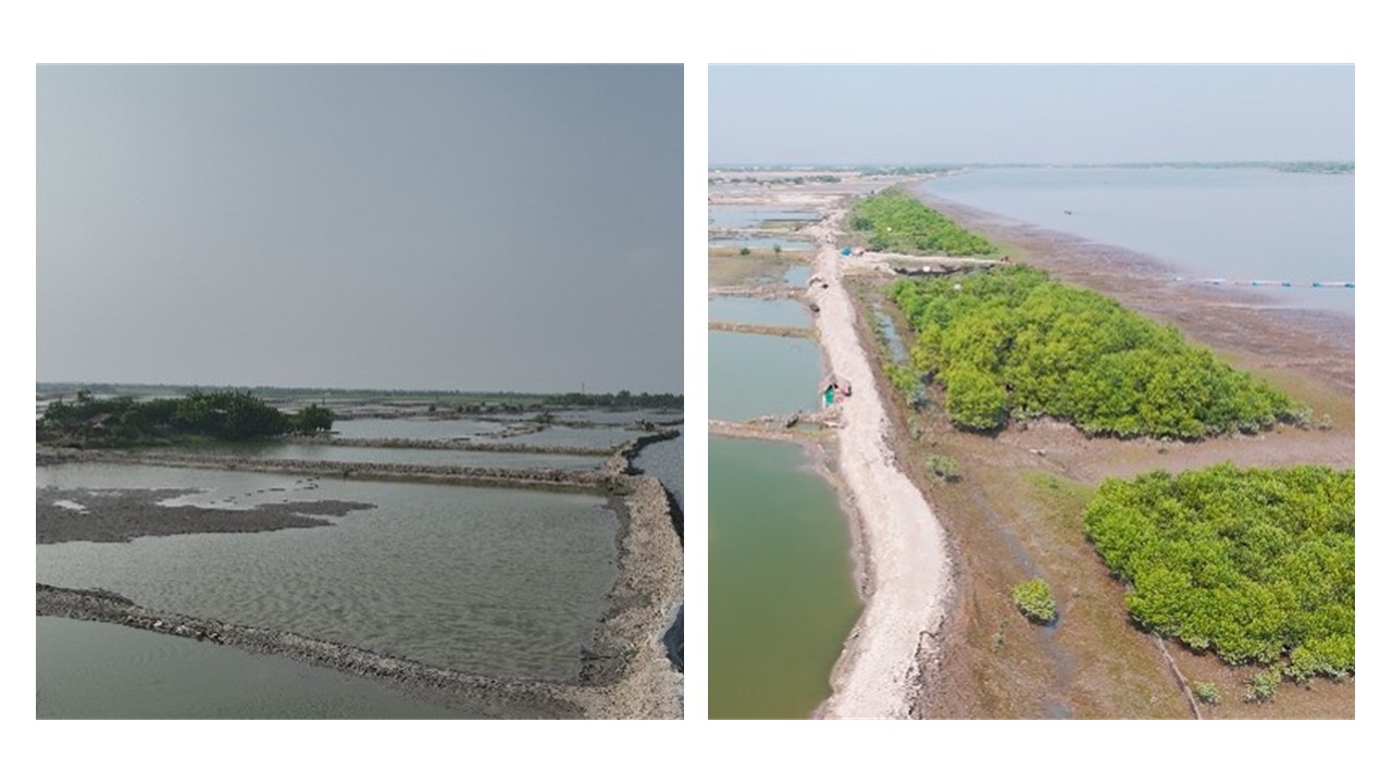
Visual documentation has become an important monitoring tool. Community members compare photographs over time to assess improvements, identify challenges, and support collective learning.
As Humiyara, a landscape volunteer, explains:
“We regularly take photos and videos. When we compare old and new images, we can clearly see the improvements and identify where more work is needed.”
By combining local observations, community discussions, and visual evidence, communities have developed a practical and reliable system for measuring change.
Evidence from Community-Led Initiatives and Result Tracking
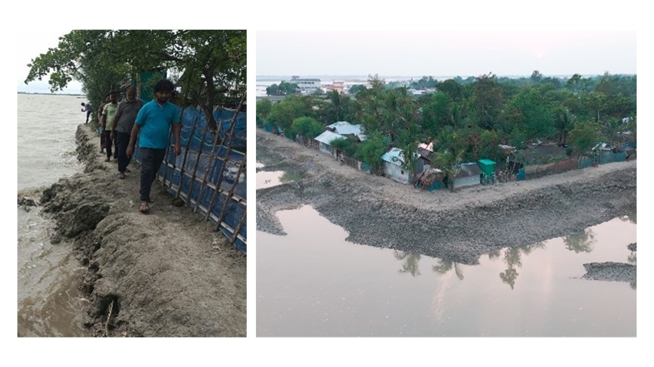
In Zeyala, community members identified blocked canals as a major cause of recurring waterlogging. Working together, they restored 1.5 kilometres of canal connectivity, significantly improving drainage across several villages.
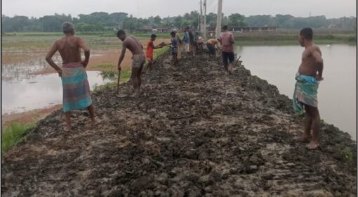
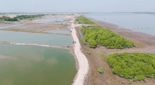
In Soladana and Chakla, where communities have long struggled with salinity and waterlogging, people mobilized local labour and collaborated with local authorities to repair embankments through the RtF programme. Today, nearly three kilometres of protective dykes help safeguard around 300 acres of land from tidal flooding.
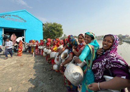
In Puijala, women and community leaders prioritized access to safe drinking water in response to the severe salinity-induced water crisis. Together, they established a community-managed reverse osmosis (RO) water treatment plant and excavated freshwater ponds. As a result, around 95 households now have improved access to safe drinking water.
Urmila, a resident of Puijala, recalls:
“For almost 15 years we drank saline water. Sometimes we walked five kilometres to collect less saline water. Today, because of our RO plant, we have safe drinking water within our own community.”
In Hajrakhali, community members repaired a 500-metre bridge and restored natural canals, improving year-round mobility while also reviving the local ecosystem. The restored canals have created new livelihood opportunities through freshwater fish farming.
In Jugipota, the community raised the school field to ensure that children could continue attending school more safely and regularly during the monsoon season.
These examples demonstrate how communities measure success through tangible improvements in their everyday lives. They assess whether water drains more effectively, whether travel has become easier, whether safe drinking water is more accessible, whether ecosystems are recovering, and whether essential community services remain available throughout the year.
Leveraging Remote Sensing for Adaptive Monitoring
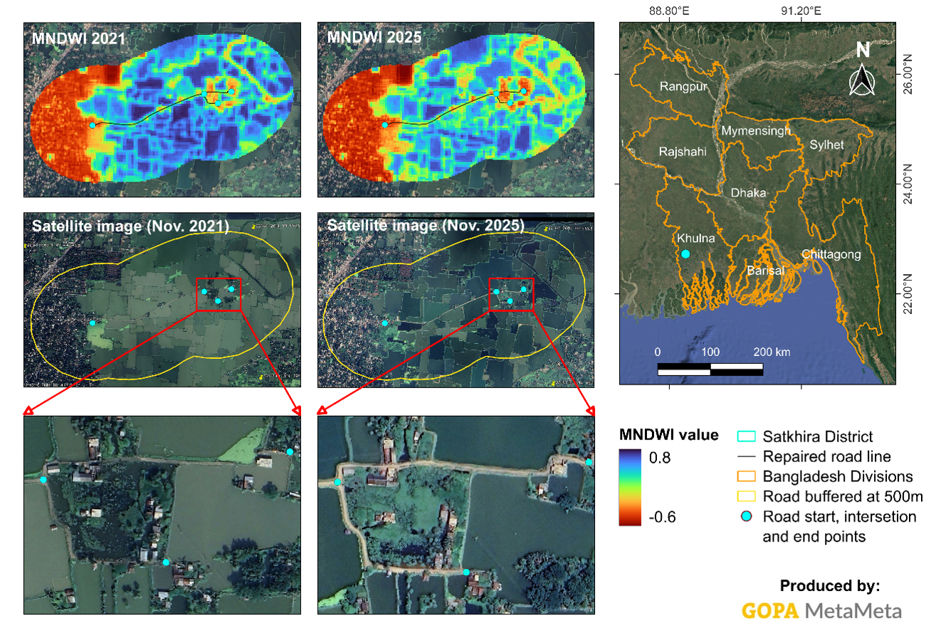
Strengthening monitoring through Remote Sensing (RS) offers a valuable opportunity to complement community-based evidence in RtF landscapes. A pilot demonstration by Gopa MetaMeta in the Godaibeel Landscape of Satkhira District, Bangladesh, used Sentinel-2 satellite imagery and high-resolution Google Earth imagery to assess the impact of a community-led road restoration intervention completed in 2025. Analysis of waterlogging conditions within a 500 m buffer surrounding the rehabilitated 1.5 km road, using the Modified Normalized Difference Water Index (MNDWI), revealed a clear reduction in surface water accumulation compared to 2021 see below map. while the Google Earth imagery showed the restored road more clearly seen and functional, alongside signs of improved land conditions in the surrounding area.
What Result Measurement means for locally led adaptation
The Uttaran experience shows that a landscape approach becomes stronger when communities define change in their own words. They understand how canals, roads, embankments, ponds, and services connect to one another. They also understand that resilience grows through collective action, women’s leadership, local monitoring, and shared responsibility.
This is an important lesson for locally led adaptation more broadly. When communities have space to decide, act, and review results together, they build solutions that fit their landscape and support everyday life in practical ways. In Satkhira and the wider southwest region of Bangladesh, measuring landscape change is therefore not only about physical works. It is also about seeing how community life becomes safer, easier, healthier, and more connected over time.