By David Mornout, Md. Zahidul Islam, and Frank van Steenbergen
Postcard from Netrokona
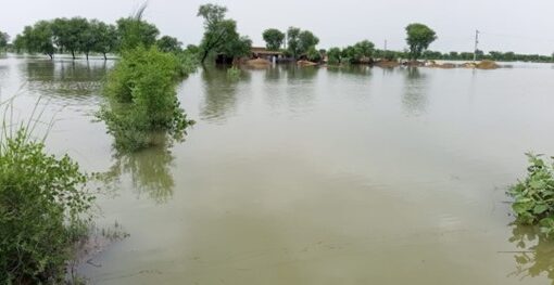
Though far away from the coast or the Bay of Bengal, Netrokona, a district in northern Bangladesh, is nonetheless totally defined by water. During the annual monsoons, the extensive shallow depressions that make up the area’s landscape, receive water from rivers and turn into vast stretches of water. These vast water bodies are called haors.
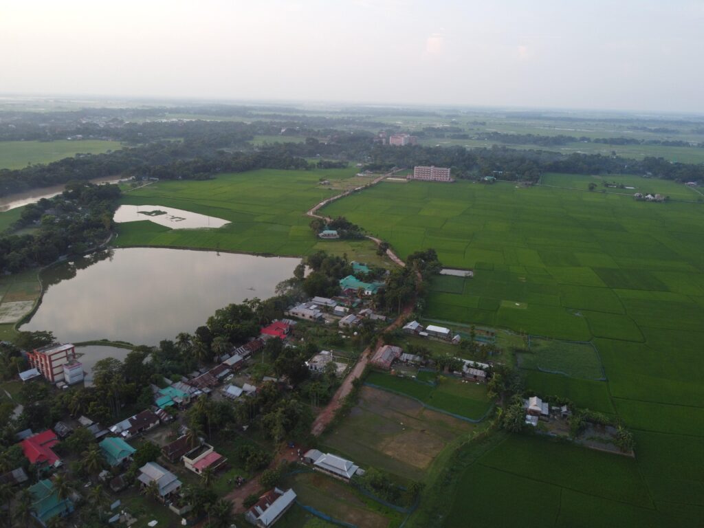
In the Haor Region, villages are built on the natural levees (known as kandas). During the dry season, temporary satellite villages are often established – deep inside the haor beds, far from the parent settlements. After the harvest, and before inundation returns, these structures are dissembled and carried back – along with the harvested produce – to the main villages
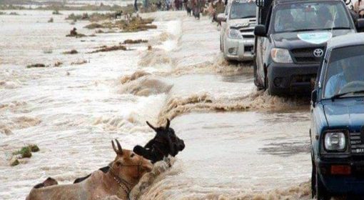
Haors support both subsistence and commercial fisheries, while the seasonally flooded margins are essential for boro rice cultivation – the main agricultural crop grown in the region. However, early monsoon flash floods routinely destroy this precious rice crop. To mitigate this, flood protection dykes- both full and submersible – have been and are being constructed in select areas. Still, significant challenges remain.
Roads in haors – more than transport infrastructure
Roads in haor regions often have a major negative impact on haor and flash flood areas hydrology: they often divide the floodplain into a wetter section and a drier section. Bridges may constrict the floodplain, and bridge sills may raise water and silt levels.
Road building in the Hoar Region requires special attention to keep floodplain conditions alive and to prevent uncontrolled breaking of the road embankment. Care is needed to prevent roads from damaging the landscape and the hydrology, and vice versa, Yet beyond minimizing harm, there is real opportunity here. Roads can be part of the solution. This is where the Green Roads for Water approach comes in:an integrated approach in which roads can become instruments for water management and flood/climate resilience. In haor regions, embracing this approach can unlock multiple benefits.
These are the opportunities.
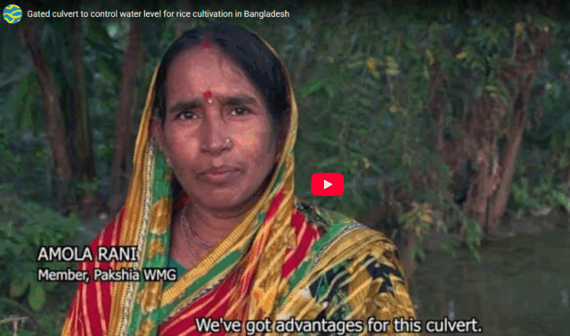
✅ Retaining Soil Moisture of the Reclining Floods
“By designing roads and overflows in the Haor, so that they help retain the reclining flood, the period of available soil moisture can be extended.”
In the haor and flash flood areas, retaining moisture from retreating flood water is a promising implementation of the Green Roads for Water principles. To do so, one needs to consider roads, and their (gated) cross-drainage structures, as instruments for agricultural water management. This requires a shift in thinking and doing. Even in the backdrop of persistent flooding of the floodplains in the Haors for eight months per year, gated culverts allow for optimizing water management. They can provide promising avenues for creating more desired circumstances, especially in the four remaining months. The video below shows the impact of gated culverts in the coastal zone of Bangladesh in detail.
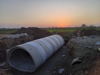
✅ Fish-Friendly Infrastructure
“By tailoring culverts and drainage structures for fish passage, fish capture can be significantly improved.”
Haors are critical fishing grounds. Yet road infrastructure, when poorly designed, can severely disrupt fish migration by altering natural water flow.
Many culverts have been historically undersized, set high in the channel, or formed a waterfall at its outlet, forming a barrier to fish and other aquatic organisms’ movement. This has effectively fragmented the stream reaches where fish can live, reducing their overall population.
By using stream simulation concepts, the culvert width matches the channel bank’s full width, and a natural channel bottom is preserved or built into the structure. This prevents either the flow is too fast, the flow is too shallow, the jump is too high, or there is no resting pool. Much can be gained by providing sufficient and well-located culverts of appropriate design to guide and facilitate fish movement. This benefits both ecosystems and livelihoods.
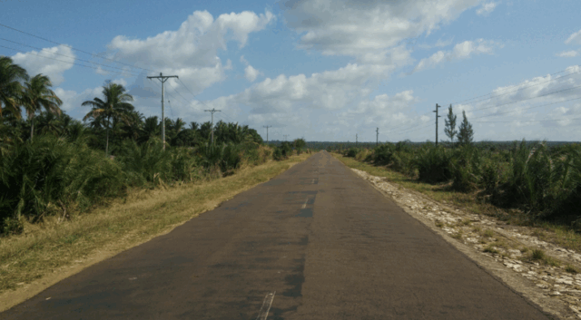
✅ Flood preparedness and recovery
“Rural roads play a critical role in disaster preparedness, response, and recovery. They function as lifelines, enabling safe evacuation, facilitating the delivery of emergency services, and supporting the distribution of relief aid”
Roads in the haor areas can also significantly contribute to flood preparedness and recovery. This involves making roads at higher elevation (for instance, by using excavated sediment) in flood-prone high-risk areas and including widened sections as flood shelter. Care must be taken not to interfere with flood patterns. Overflow structures, causeways, and proper cross-drainage can help maintain the natural floodplain dynamics while ensuring connectivity and safety.
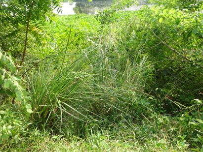
✅ Roadside vegetation
“Road functions can be optimized with well-planned roadside vegetation, protect (submerged) roads from scour.”
Strategically planted vegetation can serve multiple functions in haor regions. It plays a critical role in protecting road embankments from erosion and scour – especially when roads are submerged for extended periods. But its benefits go far beyond protection alone.
With the right selection of species – suited to local soils and climate – roadside vegetation can contribute to embankment stability, improve biodiversity, reduce dust and noise, and even offer direct productive use for local communities (such as fodder or fruit). Properly planned, it becomes a low-cost, high-value investment in more climate-resilient infrastructure.

This blog has been prepared under the “Consultancy Services for Increasing Resilience of Rural Infrastructure and Local Communities through Green Roads Concept” project, implemented by GOPA MetaMeta and ADSL for the Local Government Engineering Department (LGED) in Bangladesh and the World Bank, and aims to set the foundation for systematically integrating water management and climate resilience in road development. Under this project, country-specific Guidelines on Green Roads for Water are being developed. This work was made possible with the financial support from the Japan-Bank Program for Mainstreaming DRM in Developing Countries, which is financed by the Government of Japan and receives technical support from the World Bank Tokyo Disaster Risk Management Hub, and with support from the Global Facility for Disaster Reduction and Recovery (GFDRR), administered by the World Bank