By Merti Integrated Development Programme, supported by Theo Kioko and Femke van Woesik
This blog is part of a dossier on locally-led adaptation, featuring insights and lessons from the Reversing the Flow (RtF) program. RtF empowers communities in Bangladesh, Burkina Faso, Ethiopia, Kenya, and Sudan to build climate resilience through direct funding and a community-driven, landscape approach.
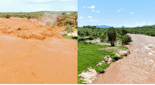
In the flood-prone areas of Merti and Garbatulla Sub-Counties in Isiolo County, communities have lived for decades with the recurring impacts of flooding along the Ewaso Nyiro River. Community members recall devastating floods that affected more than 1,500 households as the river frequently changed its course, destroying homes, infrastructure, and livelihoods. Yet amid these challenges, a quiet transformation is taking place. Communities are no longer waiting for external actors to define success and determine priorities.
Through the RtF programme, community institutions, including Flood Committees, Cluster Committees, and Landscape Committees, have become the primary drivers and monitors of landscape restoration and flood resilience efforts. For these communities, success is measured through lived experiences: homes remaining dry during floods, water reaching previously disconnected areas, and families staying safely in their villages rather than being displaced.
A turning point came in November 2025 when the Cherab Flood Committee Community-Based Organization initiated water diversion works in Godrupa. Guided by local knowledge and supported through the RtF approach, the community strategically closed and reopened sections of the Malka Funan channel to redirect floodwaters into controlled pathways flowing toward Mata Arba, Biliqi, Lower Cherab, and South Sericho. The intervention reduced flood-related damage, with the number of affected households dropping from more than 1,500 to approximately 10 households. For residents, this achievement represented much more than an engineering solution; it was a tangible demonstration of community-led protection and resilience. As one Flood Committee member explained, “The floods no longer reached our homes after the water was redirected.”
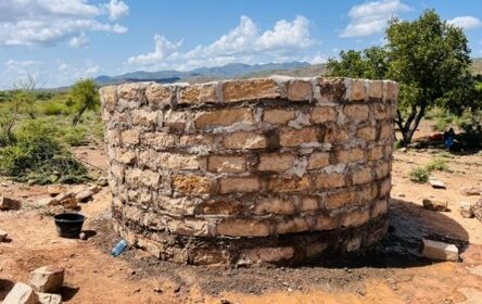
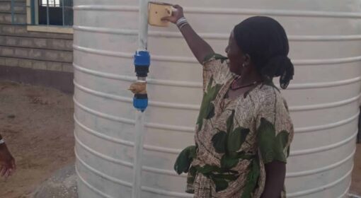
Communities are also measuring landscape restoration through improvements in water access and livelihood recovery. For five years, areas such as South Sericho and Lower Cherab experienced severe water shortages after changes in the river’s course cut off access to water. Today, water has begun flowing back into these areas, supporting the revival of small-scale farming activities, reducing the need for seasonal migration to Merti, and restoring opportunities for local livelihoods. The return of water has strengthened food production and improved household resilience to climate shocks. Reflecting on these changes, Osman Abdi, a community representative from Olla Ganna, noted, “The project brought water closer to our farms and reduced migration.”
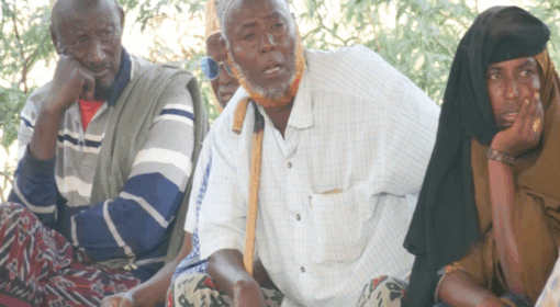
An equally important measure of success has been the growing sense of community ownership and participation. Through the RtF programme, Flood Committees, Cluster Committees, and Landscape Committees have taken on active roles in planning, implementation, monitoring, and accountability processes. Rather than being passive beneficiaries, community members directly oversee project activities, monitor resource utilization, and assess the quality of interventions. Community-led oversight covered approximately KES 3 million in restoration and flood management investments, strengthening transparency and reinforcing trust among stakeholders. Monitoring has become a horizontal process driven by local people themselves rather than a top-down exercise led solely by external actors. According to Golo Roba, a Cluster Committee member, “We monitored the work ourselves, and that strengthened ownership and accountability.”
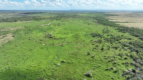
Community monitoring is carried out using a combination of simple but effective tools that are accessible to local people. Committee members organize regular joint monitoring visits to restoration sites, conducting transect walks to observe changes in river channels, vegetation recovery, flood protection structures, and water flow. During these visits, they document before-and-after photographs to visually demonstrate changes over time and compare community-generated maps showing the river’s course, restored areas, and flood-prone locations before and after interventions. Monitoring findings are shared through WhatsApp groups, enabling committee members to provide real-time updates, coordinate field activities, report emerging issues, and track implementation progress. Communities have also embraced TikTok and other social media platforms to document restoration activities, raise awareness, and showcase successful interventions to wider audiences. Alongside these qualitative approaches, the committees collect quantitative information, including the number of households affected by floods, kilometres of restored channels, acreage rehabilitated, water access points restored, participation in community activities, and households benefiting from improved water availability. These multiple sources of evidence enable communities to validate progress, make informed decisions, and demonstrate results using data they have generated and verified themselves.
As with any restoration effort, challenges remain an important part of the story. Machinery breakdowns, unexpected rainfall patterns, and logistical delays occasionally affected implementation timelines and required communities to adapt their plans. Residents also continue to identify emerging risks in areas such as Hamza Primary School, Merti Borehole, and Ganna Village, where additional interventions may be needed to strengthen resilience against future floods. However, rather than undermining progress, these challenges have encouraged continuous learning, adaptive management, and stronger local planning processes. The experience from Merti and Garbatulla demonstrates a broader shift toward locally led adaptation, where communities are not simply recipients of development assistance but decision-makers shaping their own futures. By combining local knowledge, collective action, and community-driven monitoring systems, the Reversing the Flow programme has enabled residents to define, track, and celebrate success on their own terms. As Hassan Jirma, a Flood Committee member, observed, “When communities lead, project results are visible and owned, contributing towards sustainability and impact.”
When communities determine what success looks like and actively monitor progress, ownership becomes stronger, accountability improves, and positive change is more likely to endure. Ultimately, landscape restoration is not only about managing floods or restoring ecosystems; it is about strengthening the relationship between people and the landscapes they depend upon, ensuring that resilience and prosperity can be sustained for generations to come.