Posted by Rossella Alba
May 22, 2014
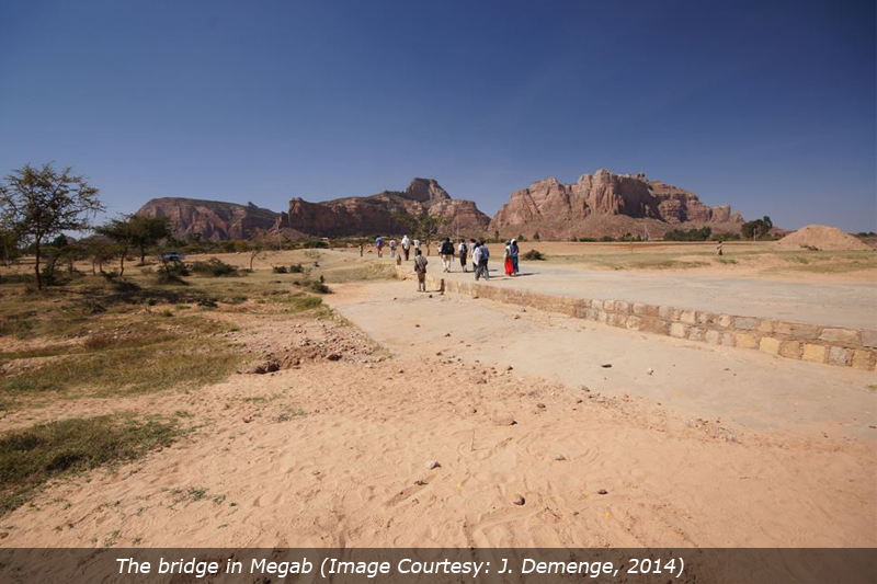
In Megab, a rather small village in the semi-arid Tigray region in northern Ethiopia, one bridge provides multiple functions to the local community. The bridge is located along the road that connects Hawzien to Abreha-we-Atzeha and Wukro. At first sight, it appears to be just a bridge. But when you look carefully, you can see it combines multiple functions: access, connection, and water harvesting
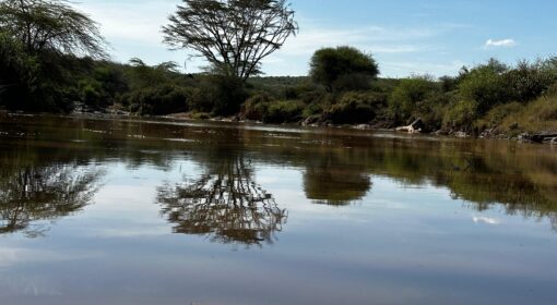
The bridge is a low-level crossing, or an ‘Irish Bridge,’ combined with a sand dam. It is made out of concrete and stones (see picture 1). During the rainy season, the water flows over the road, in the meantime sediments accumulate behind the dam. As discussed by Ian Neil (2012), sand dams combined with crossing points are a great way of increasing water availability in dry lands while enhancing connectivity in rural road infrastructure. The bridge in Megab indeed is a key crossing point for people, vehicles, and animals across the seasonal river that flows through it. Especially during the rainy season, when the bridge structure helps slow down and spread out the river flow, allowing for safe crossing. Therefore, its primary function is to provide year-round connectivity.
Secondly, the bridge plays an important role in relation to water resource management and erosion control. A farmer living in the area noticed the bridge: (1) contributing to the reduction and slow-down of run-off, (2) capturing sediments coming from the upstream portion of the catchment, thus decreasing siltation downstream, and (3) working as a water conservation measure, increasing soil moisture upstream.
 | 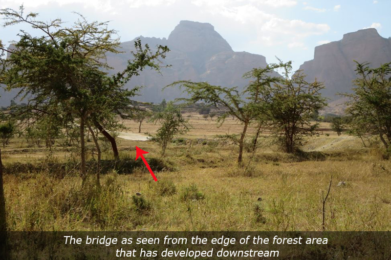 |
Soil and water conservation measures undertaken in the area further contribute to water retention and groundwater recharge. After the construction of the bridge, several lines of deep trenches were dug. As one local inhabitant noticed, ‘…before there were deep trenches in the area, there were only two trees. The area was empty, bare land’. The (coincidental) combination of the bridge and soil and water conservation measures has helped turn the area from a severely degraded, overgrazed, and erosion-prone valley to a rich forest and grazing land.
Similar infrastructures provide a great opportunity for enhancing water availability in arid and semi-arid regions. Find more information about roads and water harvesting at roadsforwater.org. Or watch the recording of the webinar ‘Roads for Water’ (organised in November 2013; watch below).
For more info on road development for groundwater recharge, visit the UpGro project website

{jcomments on}