By Redeat Daneil
The Biskilo-Wererso Watershed in Oromia, Ethiopia, is not only a place of stunning natural beauty but also a region facing numerous environmental and socioeconomic challenges. To address these issues and pave the way for a sustainable future, a participatory land use and watershed development plan has been initiated.
Challenges in the Biskilo-Wererso Watershed have significant environmental and community implications Deforestation, unsustainable agriculture, and erosion contribute to land degradation, threatening the ecosystem’s health. Diminished forest cover reduced biodiversity and exacerbates water scarcity and soil fertility degradation, impacting agricultural livelihoods. Additionally, traditional farming methods, inadequate infrastructure, and limited resources hinder farmers’ yields and incomes, leading to persistent poverty and food security concerns. To address these challenges and unlock the watershed’s potential, a comprehensive understanding of its dynamics is essential. This involves assessing ecological, social, and economic aspects through data collection, stakeholder consultation, and participatory mapping exercises. These efforts provide valuable insights into the watershed’s current state and the root causes of its challenges.
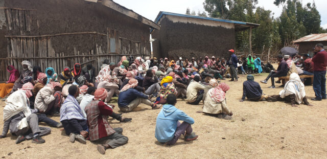
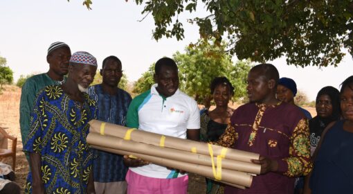
Figure 1- Community particiption on the watershed planning
Building upon an understanding of the watershed, sustainable land use and watershed development strategies are formulated, prioritizing interventions to combat degradation while considering the socio-economic context. Engaging with farmers, local leaders, and other stakeholders ensures alignment with local needs and promotes inclusive development. The spatial development plan for the Biskilo-Wererso Watershed integrates ecological and socio-economic realities and takes into account the unique characteristics of the watershed and provides a roadmap for sustainable and integrated land use practices. This way, the Green Future Farming project aims to create a thriving and resilient ecosystem that benefits both the environment and the local community. It identifies zones based on characteristics: conservation zones for forests, agricultural zones for sustainable farming (for example, climate-smart techniques and efficient irrigation methods), buffer zones for water protection against pollution and erosion, settlement and infrastructure zones for communities, and conservation and tourism zones for eco-tourism and livelihood opportunities.
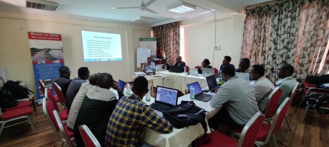
Figure 2- Training on GIS for identification and delineation of different zone

Figure 3 – Validation of land use plan with responsible governments
The spatial development plan guides land use decisions, investment priorities, and policy interventions, harmonizing environmental conservation with socio-economic development in the Biskilo-Wererso Watershed. Through collaborative and participatory planning, the project engages diverse stakeholders to ensure contextually relevant, inclusive, and sustainable strategies. This approach fosters ownership, empowerment, and recognition of local wisdom, promoting equitable development. Regular communication and shared learning platforms facilitate project success and sustainability.
Overall, revitalizing the Biskilo-Wererso Watershed through a participatory approach sets the stage for a hopeful future in sustainable land use and socioeconomic development, fostering resilience and prosperity for both the environment and the local communities.
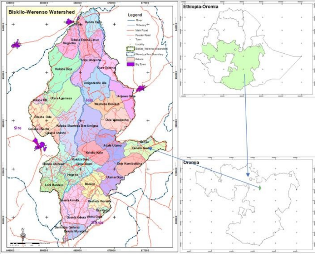
Figure 4- Location map of Biskilo-Wererso Watershed