Frank van Steenbergen, Popi Michelogiannaki and Mohammed Umar Karim
Roads in flood emergency
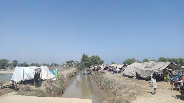
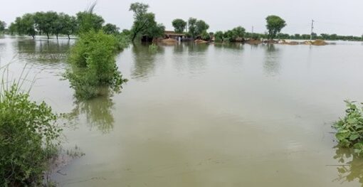
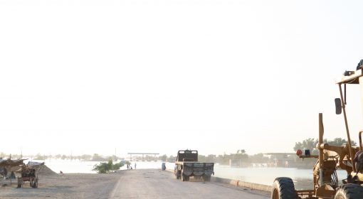
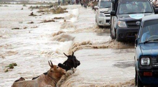
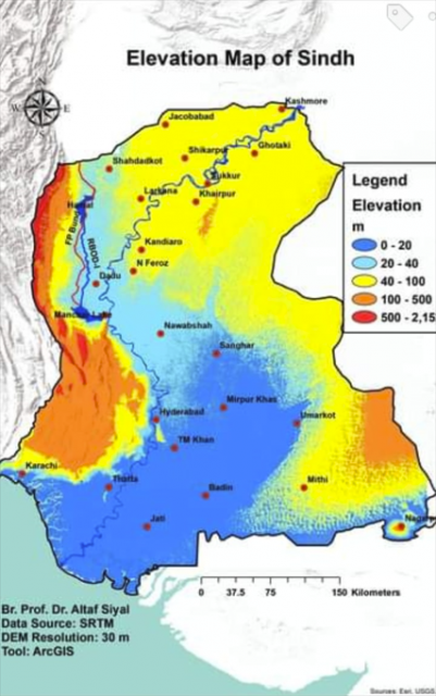
Flooding has become a recurrent disaster in Pakistan. There is a rapid succession of disastrous events since 2010, culminating in the deluge of 2022. According to National Disaster Management Authority more than 33 million people were affected by the mega-floods of 2022 in Pakistan. Sindh Province took the hardest hit, with nearly 20% of the landmass (totaling 25000 km2) of the entire Province inundated, and most of this the highly populated areas. Sindh also registered most of the 1800 deathly victims in the 2022 floods. A recurrent image is of people stranded on roads in landscapes otherwise totally underwater. The natural problem faced by Sindh province is its almost flat elevation. Technically, it is like one feet gradient every three miles.
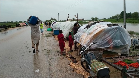
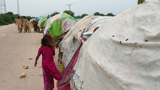
In fact, during the floods the roads assumed three important functions:
- Evacuation routes
- Flood shelters
- Supply lines for emergency relief, food and fuel
With these three functions, it is not off the mark to say that though not designed that way during the floods, roads saved thousands of lives. We may argue that these functions should be factored in the reconstruction programs.
Rebuilding roads for flood preparedness
According to Post Disaster Needs Assessment (PDNA) 8,330 kilometres of roads (about 3.2 percent of total in-service roads) and 3,127 kilometres of railway track (around 40 percent of total in-service railways) are estimated to have been damaged to various extents due to the floods. According to the PDNA the railway sector has been the most impacted, given its large pre-flood maintenance backlog
A major road reconstruction program is being planned. In line with the philosophy of ‘building back better and smarter’. The PDNA makes the point of ensuring muti-hazard disaster resilience of investments. It is indeed important to factor in flood preparedness into the design of the reconstructed roads. There are several considerations:
- First is to evaluate the road network: where were the areas where evacuation was problematic and where are the areas where emergency relief was problematic? Where are the areas where communities are still stranded on temporary islands? Where are the communication bottlenecks? This should receive priority in reconstruction with improved features (see next).
- Second is to reconsider the height of the roads. More than the local roads, the Indus Highway and the National Highway served as impromptu flood shelters, as they are built on higher embankments. Yet not all communities are close to these highways and many of the local roads were inundated. Particular in areas that were at high risk, because of their location in a flood plain or because are in a particularly low-lying part of the province, road heights may be adjusted to transport people and their belongings (including livestock) during disaster events. Rather than increasing the height of the entire road, which may be costly, higher sections may be built into the rural road network at critical locations. Particularly for earthen roads, the material maybe be available from the desilting of irrigation and drainage canals.
- Third is to include flood shelters in the roads design. The same was proposed in the Left Bank Drainage Master Plan, prepared by Louis Berger, and associated consultants after the 2010 floods: “Elevated platforms or widened sections along the existing roads and canal bunds would also help in finding refuge from flood waters.” This could be spaced alongside raised roads strategically to be accessible throughout flood-prone areas. Despite emergency preparedness programs and early-warning systems, a plan for marking the evacuation routes should be developed and embedded to disseminate warning messages for residents to evacuate and follow the priority routes to the closest shelter.
- Fourth is to take a complete approach to road reconstruction. The same roads that served as flood shelters in some cases also aggravated the flood problems as they block run-off and impede natural drainage. In rebuilding roads smart and appropriate cross drainage is required. In some areas roads can also be used to temporarily retain and store water.
Because of their omnipresence, including the flood risk preparedness elements in the transport infrastructure recovery programs is a must.