By Popi Michelogiannaki, Frank van Steenbergen, and Mohammed Umar Karim
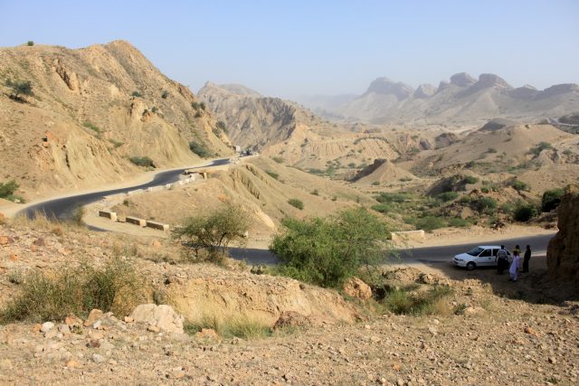
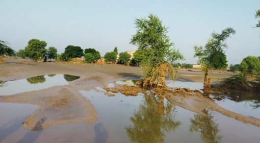
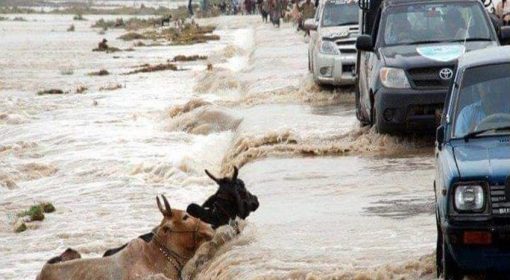
Water can be retained for a longer period in higher areas that may serve as storage for lower. During the floods of August 2022 in Pakistan, the mountainous regions dealt more with flash floods coming from the hill slopes of Balochistan province, whereas in Sindh province the problem was more about the water in the plains. The flash floods not only affected the low-lying areas alongside the riverbanks, but also increased flood velocity and caused the banks to erode.
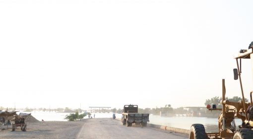
According to the National Disaster Management during the floods of August 2022 in Balochistan, 34 districts and at least 360,000 people have been affected, including 238 people killed and 106 people injured. In addition, 1,000 km of roads and 18 bridges have also been damaged and impeded access across flood-affected areas. The towns in Balochistan are scattered over long distances. During the floods it was reported that 69 per cent of villages had problems with accessibility.
In Green Roads for Water, the road environment can create a large productive asset in the uplands by retaining floodwater that can be widely distributed for recharge of groundwater and agricultural purposes.
The rainwater catchment capacity of Balochistan uphill could have a beneficial impact for both Balochistan and Sindh provinces which are the main recipients of rainwater. The rainfall in the region is scanty and unevenly distributed. Rainfall in the area varies from 37 mm in the southwest desert to 397mm in the northeast annually, and its amount varies over time and space in different seasons. Overall, the Balochistan province is mainly comprised of arid regions.
ROADS FOR WATER OPPORTUNITIES
The primary source of income for 85% of Balochistan’s population is agriculture while the province is facing many severe droughts and floods. By systematically capturing rainfall with road infrastructure, rain-related road damage is reduced, erosion and landscape degradation due to road development is lessened, and farm incomes increase due to the beneficial use of harvested water. Retention of rainfall in arid areas is of vital importance because it ensures the availability of water and moisture for productive and consumptive use during dry periods. Moreover, especially if performed intensively, the impact of water harvesting goes beyond providing more water for agriculture. It improves the landscape microclimate because increased moisture in the soil will affect soil temperature and thus the area’s ability to deal with temperature shocks.
Combined measures of catchment and storage can contribute to gradually minimizing water flows and prevent flooding in undesired locations. The compartmentalization of land at different levels can take place not only on roads but also in the areas upstream and downstream of roads.
- To start with the upstream water catchment, hill-side storage ponds (or dams) can be used to harvest and store rainfall or runoff water. Water is stored during periods of high rainfall, while it can be released, for agricultural purposes or domestic use, during dryer periods. Hill-side dams are built in the highlands on almost all kinds of sloping land and are easy and cheap to construct and maintain.
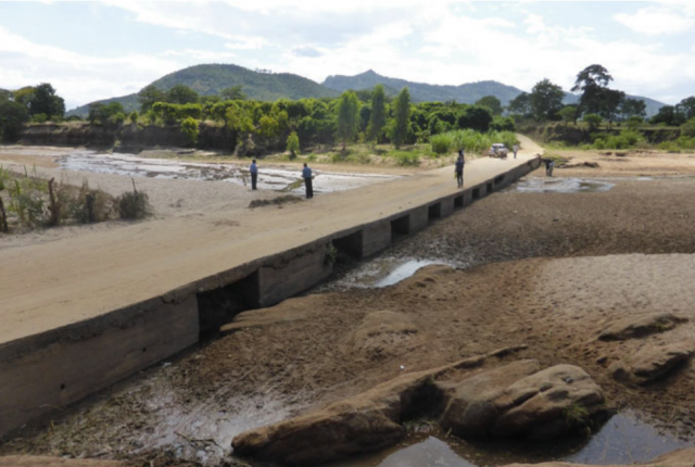
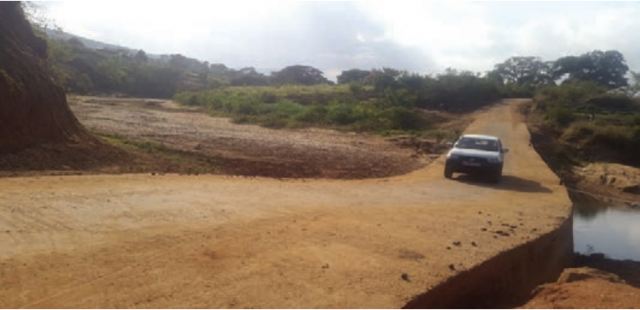
- To continue with, the importance of riverbeds in Balochistan is evident, since Balochistan dealt with heavy rainfalls but had also faced severe droughts in the past. Road drifts if constructed well, they will retain subsurface water upstream. When roads cross dry riverbeds or water streams, drifts are often constructed. These road crossings can help retain groundwater upstream of the road crossing and can increase bank infiltration. If a riverbed is filled with a thick layer of sand gravel, the river can feed the groundwater adjacent to it. Building a series of such stabilizing structures on a stream at different road crossings is the preferred option for riverbed stabilizers. Wells or infiltration galleries can then be constructed to gain access to the water retained upstream of the drift. On low-volume roads, road drifts are more economical and are preferred to conventional bridges across expansive dry rivers with occasional floods. The drifts may not be passable during floods, but the construction cost of a road drift is substantially lower than that of a conventional bridge.
- Moreover, during rain events, road surfaces generate a large amount of runoff coming from the upper catchment and passing through the culverts and side drains of roads. In order to not accelerate and concentrate runoff between roads and landscape, the first need is to protect road infrastructure by efficiently capturing rainwater and then to revise drainage location to preserve natural hydrology.
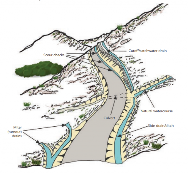
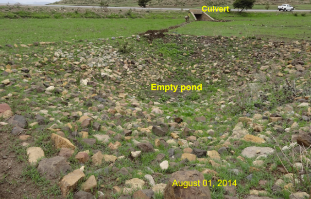
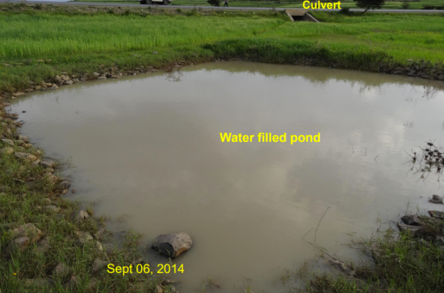
- Once the rainwater has been harvested properly, road drainage can be used for storage and recharging. Roadside drains, culverts and road embankments divert runoff into farmlands using soil or stone bund water channels. This water can be easily utilized by diverting it to nearby farmlands for supplemental irrigation.
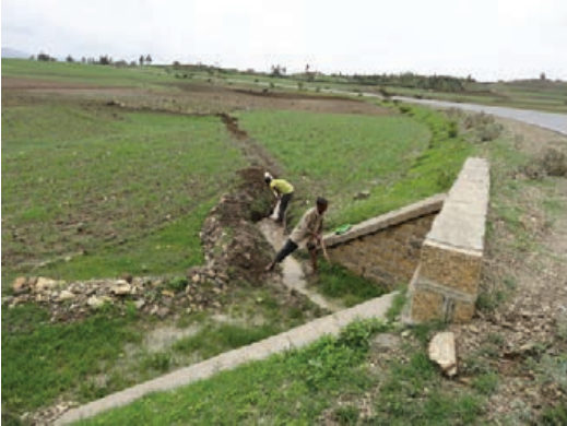

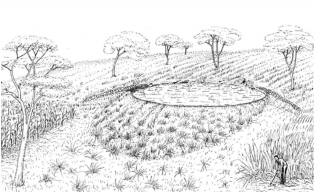
Image 6: V-shaped floodwater spreader Source: MetaMeta, (www.roadsforwater.org) - Road drainage structures can be used not only for cross drainage but also to feed water sources for storage ponds or for enhanced recharge areas lower than the road catchment. A large proportion of the runoff on the road catchment can be retained by implementing water conservation techniques, such as percolation ponds.
Benefits:
Harvesting larger amounts of water can also reduce the volume of potentially destructive stormwater in the lower part of the watershed. Intensive water retention can store a large amount of water and can change the water cycle of large areas by affecting water availability for crops and soil processes that accelerate natural fertilization, and by creating microclimates that are more conducive to vegetation and agriculture, thus reducing the risks of drought and water scarcity.