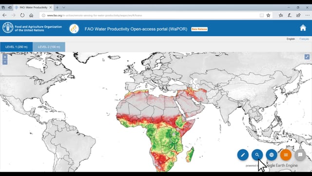
How can one use freely available remote sensing data, covering a significant time period, to monitor the impact of refugee communities on the natural environment? Studies regarding this are few and far between. Many of these studies are based on elaborate methodologies that require a lot of time.
Is there a quicker way to go about this? This webinar (June 22, 2021) discusses a study that explored exactly that. It used indices with satellite imagery of 8 refugee camps in Ethiopia, going as far back as 1984. The camps are from both wet and dry climatic areas. They have been monitored for land cover, vegetation, and area under surface water. The study also assessed potential relationships between the identified impacts, refugee numbers, and the surrounding local communities. It also examined the pros and cons of using indices from open-access remote sensing data for the purpose of assessing refugee communities’ impacts on their surrounding natural environment.
Using remote sensing for rapid assessment of refugee communities’ impact on local environment
Subscribe to our Newsletter
- Dossier
- Small Water Cycles and Local Climates
- Tags
- monitoring refugees DUPC Webinar's
- Date
- June 22, 2021
- Views
- Language
- English
- Region
- Ethiopia
- Produced by
- TheWaterChannel