By Ashfaque Soomro and Dr. Frank van Steenbergen
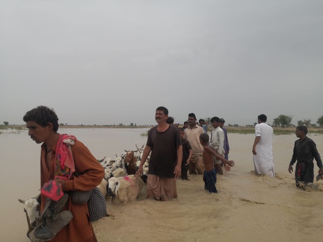
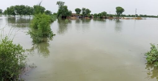
Sindh, the Southern province in Pakistan, the land of prehistoric culture and civilization, is now prone to frequent natural disasters, which undo development investment and efforts of the communities, amid the climate crisis. Of them, the floods are more devastating. It has witnessed four catastrophic floods over the past decade. Two of them were regarded as super floods due to their scale and intensity: the floods of 2010 and 2022. Alone in 2022, around 33 million people were affected, out them 38% were in Sindh.
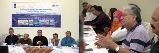
Understanding why Sindh is severely affected by floods was a key discussion agenda of a multi-stakeholder consultative dialogue held on August 8, 2024, in Hyderabad, organized under the Dutch Disaster Risk Reduction Program, by MetaMeta Research Netherlands. This session brought together 37 participants from Sindh’s water sector, disaster management authority, civil society, government, academia, community leaders, women’s associations, and media. The discussion centered on the 2022 flood emergency, evaluating preparedness, resilience, and strategies for future flood mitigation.
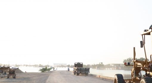
A major concern highlighted during the dialogue was the encroachment and construction on old waterways. Participants reflected that these natural flood paths have been blocked or redirected, preventing floodwaters from discharging as they historically did. Participants pointed out that while historically, riverine and spate areas in Sindh benefited agriculture by flooding, encroachments have diverted floodwaters towards major villages and towns. It was unanimously reflected and agreed that rehabilitating these natural waterways is crucial to mitigating flood damage.
Another problem associated with it is the water diversions, which are mostly discussed after every flood. Participants discussed the politicization of water diversion decisions, which should ideally be based on technical assessments. They underscored the need for regular maintenance and capacity enhancement of the drainage system. The Left Bank Outfall Drain (LBOD) was particularly scrutinized due to its design flaws, which exacerbate flooding in lower districts. A detailed and timely technical study to explore the feasibility of water storage in LBOD during inundation periods to improve flood management was recommended by the participants.
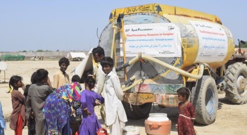
The dialogue also addressed the growing impact of climate change, which has introduced new challenges such as urban flooding. Participants stressed the importance of understanding and adapting to these emerging phenomena. Despite existing rain advisories, the activation of community networks and disaster risk reduction (DRR) forums remains a challenge. There are some anticipatory action projects in Sindh; however, there is a need to adopt a proactive role in DRR rather than focusing solely on humanitarian response.
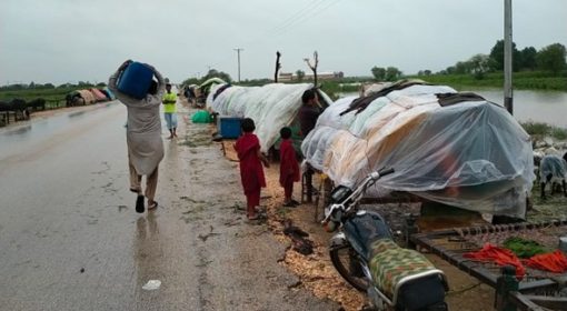
Inadequate outreach and misinterpretation of early warnings lead to confusion and hinder rescue and relief efforts by the communities. Although cellular networks have expanded to rural areas of Sindh, understanding early warning messages remains a challenge. Simplifying these messages and establishing localized weather stations could greatly enhance the efficacy of early warnings and improve community response.
Flood risk monitoring has been insufficiently community-based. Participants advocated for community-centered disaster management planning, suggesting the formation of community volunteer systems to engage with district authorities. A robust contingency plan should include responses not only to floods but also to heatwaves and droughts. Participants raised concerns about the resilience of infrastructure, specifically roads and communication networks. Modern infrastructure needs to be more resilient to withstand floods to ensure communication and facilitate relief operations.
There are some important and technical documents about the flood risk management, like the Lower Indus Development Plan of 1966 and the Bund Manual, which need to be brought within the reach of communities and educate them in simple local language so that they can understand and follow up with the authorities. Widespread dissemination and understanding of documents. Educating youth and government officials on these resources can improve flood resilience and risk management.
Technical issues related to land topography were also discussed. The flat terrain of lower Sindh contributes to issues like salinity and waterlogging. Participants suggested leveraging the region’s natural slope to develop long-term solutions such as groundwater recharge programs and better floodwater management strategies.
This consultative dialogue was a critical step towards addressing the frequent flooding issues in Sindh. The insights gained from this session underscore the need for comprehensive strategies that include rehabilitating natural waterways, improving drainage infrastructure, enhancing early warning systems, and fostering community engagement in disaster risk reduction. By addressing these areas, Sindh can move towards a more resilient future, better equipped to handle the challenges posed by flooding. These recommendations aim to address the multifaceted challenges of flood management in Sindh and build a more resilient and adaptive approach to disaster risk reduction.
The session was organized by MetaMeta under the auspices of Dutch Disaster Risk Reduction and Surge Support Program, by RVO.